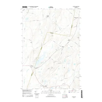
2014 Map of Palermo
USGS Topo · Published 2014About this map
Palermo and its outlying crossroads define this section of the Maine interior, where the Kennebec Co and Waldo Co line divides the landscape. The region is characterized by a dense network of freshwater bodies, with the expansive Sheepscot Pond and the winding W Br Sheepscot River serving as primary geographic anchors. Small clusters of settlement are found at North Palermo, Greely Corner, and Carrs Corner, while many family-named cemeteries such as Lincoln Cem and Osgood Cem are scattered across the hills. For local historians, the map preserves the exact locations of these resting places and the alignment of rural thoroughfares like Hostile Valley Rd and Besse Ridge Rd as they appeared in 2014. The terrain is notably punctuated by numerous smaller ponds, including Dutton Pond and Bowler Pond, which alongside Fifteenmile Stream suggest a landscape deeply shaped by glacial activity.
Find a feature on this map
95 named features on this map. Tap any name to fly to it.
Don’t see what you’re looking for? This feature index may not catch every label — zoom into the map to look around manually.
Map Details
Editions of this 2014 Palermo Map
This is the sole edition of this map. No revisions or reprints were ever made.
Other maps of this area

1892 · Waterville
USGS Topo · 1:62,500

1893 · Vassalboro
USGS Topo · 1:62,500

1898 · Vassalboro
USGS Topo · 1:62,500

1916 · Liberty
USGS Topo · 1:62,500

1926 · Burnham
USGS Topo · 1:62,500

1941 · Vassalboro
USGS Topo · 1:62,500

1942 · Liberty
USGS Topo · 1:62,500

1943 · Vassalboro
USGS Topo · 1:62,500

1943 · Waterville
USGS Topo · 1:62,500

1948 · Bangor
USGS Topo · 1:250,000