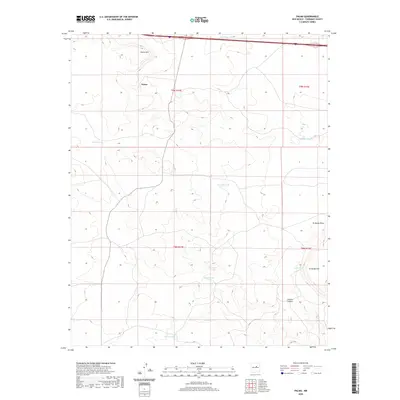
2020 Map of Palma
USGS Topo · Published 2020About this map
Palma sits at the heart of this Torrance County landscape, a rural settlement defined by its high desert terrain and livestock infrastructure. The area’s geography is shaped by drainage patterns like El Marge Draw and the deep relief of Carrizo Canyon, while prominent elevations such as Palma Hill and El Marge Hill provide natural landmarks. This 2020 survey illustrates a land management system heavily dependent on water catchment, as evidenced by the numerous named tanks scattered across the township lines. Ranching history is tied to these specific water sources, including Guadalupe Tank in the north and the centrally located Rock House Tank and Archuleta Tank. These features, along with names like Gonzales Tank and Bear Tank, reflect a legacy of land use where small-scale water improvements allowed for habitation and agriculture in an arid environment.
Find a feature on this map
17 named features on this map. Tap any name to fly to it.
Don’t see what you’re looking for? This feature index may not catch every label — zoom into the map to look around manually.
Map Details
Editions of this 2020 Palma Map
This is the sole edition of this map. No revisions or reprints were ever made.
Other maps of this area

1890 · Bernal
USGS Topo · 1:125,000

1891 · Bernal
USGS Topo · 1:125,000

1894 · Bernal
USGS Topo · 1:125,000

1894 · Lamy
USGS Topo · 1:125,000

1954 · Santa Fe
USGS Topo · 1:250,000

1954 · Fort Sumner
USGS Topo · 1:250,000

1958 · Fort Sumner
USGS Topo · 1:250,000

1958 · Santa Fe
USGS Topo · 1:250,000

1963 · Jacinto Mesa
USGS Topo · 1:24,000
1963 · Potrillo Hill
USGS Topo · 1:24,000