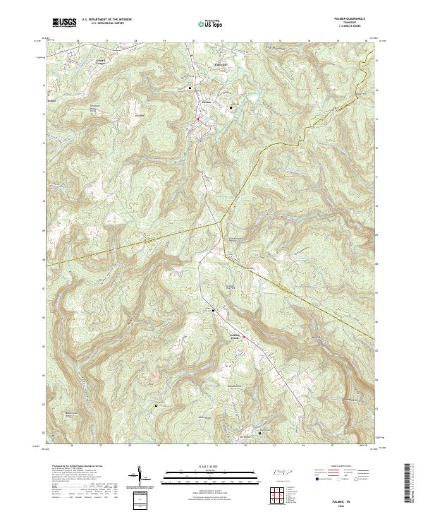
2022 Map of Palmer
USGS Topo · Published 2022About this map
Palmer sits at the heart of this landscape, positioned where the Cumberland Plateau drops toward the creek-veined lowlands. The settlement patterns here follow the sharp topography of the Tennessee Valley Divide, with communities like Gruetli-Laager and Tatesville situated along the high ridges. This area is characterized by deep gulfs and coves, such as Bearpen Gulf and Lenny Harris Cove, which create natural boundaries between the scattered mountain settlements. For local historians, the map identifies several family-named burial sites including Layne Cem, White Cem, and Presnell Cem, often located near crossroads or tucked into hollows like The Pocket. The transition from ridge-top roads like Daus Mountain Rd to the winding creek valleys below, including Griffith Creek, illustrates the enduring relationship between the geography of the plateau and the development of these Tennessee communities.
Find a feature on this map
87 named features on this map. Tap any name to fly to it.
Don’t see what you’re looking for? This feature index may not catch every label — zoom into the map to look around manually.
Map Details
Editions of this 2022 Palmer Map
This is the sole edition of this map. No revisions or reprints were ever made.
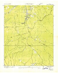
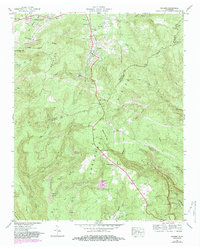
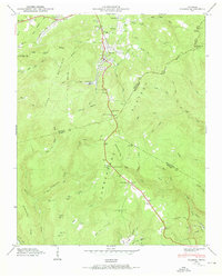
Historical Maps of Palmer Through Time
4 maps found