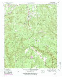
1947 Map of Palmer
USGS Topo · Published 1983About this map
Palmer Mine and the Reel Cove Mine anchor the industrial landscape of the Cumberland Plateau in this mid-century topographic record. The area is defined by the Tennessee Valley Divide, which separates the northern drainages like Fall Cr and Lick Creek from the deep southern hollows of Bearpen Gulf and The Pocket. Cultural history is preserved through the names of family burial sites such as Fall Creek Cem and Layne Cem, while the rugged geography necessitated specialized transport infrastructure like the Conveyor Belt near Reel Cove. The settlements of Gruetli-Laager and Palmer serve as local hubs, connected by winding mountain roads that traverse Luchsinger Gap and pass landmarks like the Lookout Tower. The intricate stream networks, including the Ground Hog Fork and Griffith Creek, illustrate the complex drainage patterns that carved the surrounding ridges and flats.
Find a feature on this map
66 named features on this map. Tap any name to fly to it.
Don’t see what you’re looking for? This feature index may not catch every label — zoom into the map to look around manually.
Map Details
Editions of this 1947 Palmer Map
2 editions found
Other maps of this area

1888 · Chattanooga
USGS Topo · 1:125,000

1893 · Chattanooga
USGS Topo · 1:125,000

1895 · Sewanee
USGS Topo · 1:125,000

1936 · Palmer
USGS Topo · 1:24,000

1936 · Daus
USGS Topo · 1:24,000

1936 · Whitwell
USGS Topo · 1:24,000

1936 · Tracy City
USGS Topo · 1:24,000

1936 · Ketner Gap
USGS Topo · 1:24,000

1936 · White City
USGS Topo · 1:24,000
1936 · Savage Point
USGS Topo · 1:24,000