Old Maps of Grundy County, Tennessee
Explore 136 old maps of Grundy County, spanning from 1888 to today. These high-resolution historic maps reveal how streets, neighborhoods, landmarks, and natural features evolved over time — perfect for genealogy, metal detecting, research, and local history exploration.
What you can do with these maps:
- See how Grundy County changed over time: Compare historical maps to modern-day views to trace roads, homesites, rail lines & more.
- View detailed metadata: Each map includes creators, publishers, year, scale, and archive source.
- Overlay maps with satellite & LiDAR: Visualize the past alongside modern tools to explore terrain & human change.
- Trusted historical sources: Maps sourced from the USGS, Library of Congress, and other archives.
- Access maps your way: View online, download high-res files, or order prints for personal or research use.
Start exploring old maps of Grundy County to uncover forgotten places, hidden landmarks, and the deep history beneath your feet.
Grundy County, TN maps
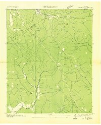
(136)- 1888 Map of Chattanooga
 1888 Chattanooga1888 Print · USGSSoutheast Tennessee in the late nineteenth century was a landscape of river ferries and mountain mining. Trace family roots and vanished landmarks near Chattanooga, from the Aetna Mines to historic river crossings like Harrison Ferry.
 - 1893 Map of Mc Minnville
 1893 Mc Minnville1893 Print · USGSThe river-and-rail economy of Warren and DeKalb counties is captured here in the 1890s. Researchers can trace old ferry crossings like Pin Hook Ferry and local industry at Daly Mill or Magness Mills.
 - 1893 Map of Chattanooga
 1893 Chattanooga1893 Print · USGSSoutheast Tennessee is shown here in the 1890s, when river ferries and coal mines defined the landscape around the booming hub of Chattanooga. Genealogists and researchers can trace family lands near Eldridge Landing, the Mc Nabb Mines, or old settlements like Ooltewah.9 unique versions available
 - 1895 Map of Mc Minnville
 1895 Mc Minnville1895 Print · USGSWarren and DeKalb Counties in the 1890s are defined by the winding Collins River and the early rail lines connecting the Highland Rim. Genealogists can trace family footprints near Magness Mills, White Seminary, or old river crossings like Bailiff Old Ferry.5 unique versions available
 - 1895 Map of Sewanee
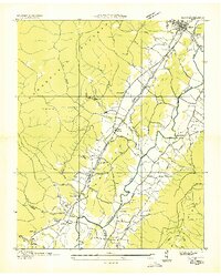
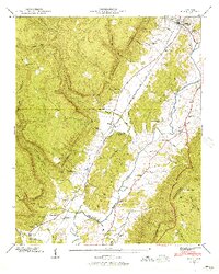
 1895 Sewanee1895 Print · USGSThe Cumberland Plateau and Sequatchie Valley come alive in the late nineteenth century, showing a landscape shaped by coal, iron, and the rails. Genealogists and historians can trace family-named coves and industrial sites like the Cowan Tunnel, Beersheba Springs, and the Stone Quarry.6 unique versions available
 - 1936 Map of Palmer
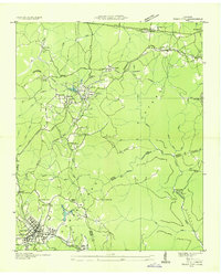
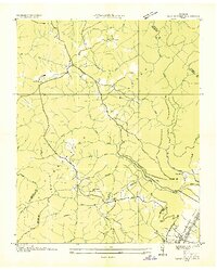
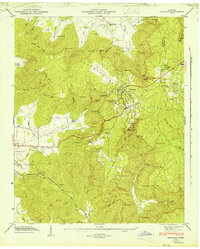
 1936 Palmer1936 Print · USGSMid-1930s Grundy County comes alive through this look at the plateau's rail-and-coal industry. Trace the complex narrow gage routes serving the Clifty Mines or locate family roots near Tatesville and Griffith Sch.
 - 1936 Map of Daus
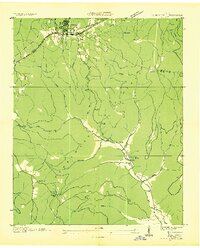
 1936 Daus1936 Print · USGSThe Sequatchie Valley was a bustling corridor of rail and river industry in the mid-1930s, caught between the Cumberland Plateau and Walden Ridge. Genealogists and historians can locate old schools and cemeteries like John Henry Chapel Sch, Stone Cem, and the community of Cartwright.
 - 1936 Map of Sewanee
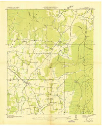
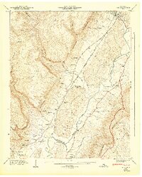
 1936 Sewanee1936 Print · USGSThe Cumberland Plateau and the Sewanee campus are captured here in the mid-1930s, showing a unique mountain landscape of academics and industry. Trace family roots at Cherry Cem or follow the path of the Cowan Tunnel and the Kelley Mine.
 - 1936 Map of Alto
 1936 Alto1936 Print · USGSThe Elk River valley at the Coffee and Franklin County line was a landscape of small settlements and river crossings in the mid-1930s. Genealogists can trace family roots through landmarks like Patton Sch, Bells Mill, and the Abernathy Cem.
 - 1936 Map of Burrow Cove
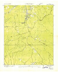
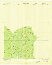
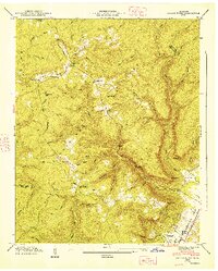
 1936 Burrow Cove1936 Print · USGSThe Cumberland Plateau of Tennessee is shown in the mid-1930s, featuring the deep hollows and high points of Grundy County. Researchers can trace historic landmarks like Wonder Cave, CCC Camp No 1476, and rural centers such as Piedmont and Summerfield.
 - 1936 Map of Tracy City
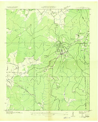
 1936 Tracy City1936 Print · USGSThe industrial and social fabric of the Cumberland Plateau is detailed here in the mid-1930s. Genealogists and local historians can trace the rail networks of the St Louis and Chattanooga Railroad and locate community landmarks like Burkett Chapel and the Nyack Sch.
 - 1936 Map of Monteagle
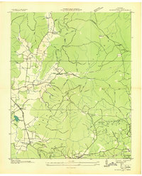
 1936 Monteagle1936 Print · USGSMonteagle and the surrounding Cumberland Plateau are captured here in the mid-1930s, showing the complex interaction between mountain travel and valley settlement. Researchers can trace historic schools and churches like Jumpoff Sch, St Johns Ch, and the high-altitude Monteagle Falls.
 - 1936 Map of Morrison
 1936 Morrison1936 Print · USGSThe Barren Plateau in the mid-1930s shows a landscape of upland drainage and early utility expansion. Local researchers can trace the Tennessee River Basin Divide and early infrastructure like the T E P C O Trans Line and Grassy Pond.
 - 1936 Map of Hillsboro
 1936 Hillsboro1936 Print · USGSCoffee and Grundy counties appear here during the mid-1930s, showing the rural landscape where the Tennessee Basin meets the plateau. Genealogists can locate family landmarks like Price Cem, Zion Hill Ch, and schools such as Stephenson Sch.
 - 1936 Map of White City
 1936 White City1936 Print · USGSMarion and Grundy Counties were still defined by remote plateau life and timber or mining interests in the mid-1930s. Genealogists can locate family homesites near White City, Lankford Town, or rural schools like Prior Sch and Foster Falls Sch.
 - 1936 Map of Cane Hollow
 1936 Cane Hollow1936 Print · USGSThe Cumberland Plateau in the mid-1930s is captured here just as modern aerial surveying began to detail its complex drainage basins. Trace the old path of State Highway No 108 and locate landmarks like the Altamont Fire Tower and the headwaters of the Elk River at Burrows Cove.
 - 1936 Map of Savage Point
 1936 Savage Point1936 Print · USGSThe high Cumberland Plateau meets the Sequatchie Valley during the mid-1930s, showing the early reach of regional power lines. Researchers can find family burial sites like Mc Laughlin Cem, the local Fredona Sch, and Travis Mill on the creek.
 - 1943 Map of Mc Minnville, 1944 Print
 1943 Mc Minnville1944 Print · USGSMid-Tennessee is captured here during the mobilization of the early 1940s, showing the vast Camp Forrest Military Reservation and thriving rail towns. Trace the N C & ST L line through Mcminnville or locate smaller rural hubs like Morrison and Hickerson Station.
 - 1946 Map of Savage Point
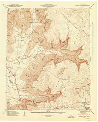
 1946 Savage Point1946 Print · USGSThe town of Dunlap and the surrounding heights of the Cumberland Plateau are captured here in the mid-1940s. Genealogists and historians can trace local landmarks like Sequatchie County High Sch, King Cem, and Cagle.4 unique versions available
 - 1946 Map of Sewanee, 1947 Print
 1946 Sewanee1947 Print · USGSSewanee and the surrounding plateau heights are captured here just after the war, showing the deep connection between the university and the mountain. Genealogists and historians can trace rail history at the Cowan Tunnel or locate family plots at Harrison Cem and St Marys Cem.4 unique versions available
 - 1946 Map of Daus, 1956 Print
 1946 Daus1956 Print · USGSThe Sequatchie Valley is captured just after the war as the mountain and valley economies intertwined. Genealogists and historians can trace family roots through numerous sites like Hatfield Cem, New Hope Ch, and the rail stops at Daus and Dunlap.6 unique versions available
 - 1947 Map of Daus
 1947 Daus1947 Print · USGSThe Sequatchie Valley floor and the steep Cumberland Escarpment appear here just after the war, at a peak of rail-and-river connectivity. Researchers can trace family history through a dozen rural landmarks like Stone Cem, Cedar Spring Sch, and Daus.
 - 1947 Map of Burrow Cove, 1948 Print
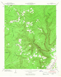
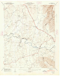
 1947 Burrow Cove1948 Print · USGSThe Grundy County uplands come alive in this post-war survey, showing the intricate relationship between the steep cove terrain and early valley settlements. Researchers can trace rural life through the many schools and cemeteries, from Wonder Cave and Payne Cove Sch to the Nashville Chattanooga and St Louis Railroad.7 unique versions available
 - 1947 Map of Savage Point, 1948 Print
 1947 Savage Point1948 Print · USGSThe Sequatchie Valley and Cumberland Plateau meet in this mid-century survey as the town of Dunlap begins its post-war growth. Researchers can trace rural lineages through sites like Lands Chapel, King Cem, and the Sequatchie County High Sch.
 - 1947 Map of Alto, 1948 Print
 1947 Alto1948 Print · USGSThe Elk River valley at the foot of the Cumberland Escarpment was a network of close-knit farming communities in the late 1940s. Genealogists can trace family names through dozens of sites like Mt Pleasant Cem, Thompson Hall School, and Bells Mill.8 unique versions available
Showing maps 1-25 of 136
Top cities of Grundy County
- Gruetli-Laager historical maps
- Tracy City historical maps
- Altamont historical maps
- Coalmont historical maps
- Palmer historical maps
- Beersheba Springs historical maps
Frequently asked questions
- What are the different types of historical maps available for Grundy County?
- What is the oldest map of Grundy County?
- Where can I purchase historical maps of Grundy County for my home or office?
- Where can I download high-res historical maps of Grundy County?
- Are there historical topographic maps available for Grundy County?
- Is there historical aerial imagery available for Grundy County?
- Where are historical maps of Grundy County sourced from?