1940s Maps of Grundy County, Tennessee
Explore 11 historic maps of Grundy County from the 1940s. These maps offer a rare glimpse into what life looked like during the 1940s — showing old roads, neighborhoods, homes, and landmarks that have changed or disappeared over time.
Whether you're researching your family's past, planning a metal detecting trip, or studying how Grundy County's landscape evolved across the 1940s, these high-resolution maps are a powerful tool for exploring the history of this region.
- Focus on a specific era: All maps on this page are from the 1940s, giving you a focused view of this time period.
- See what’s changed: Compare century-old streets, trails, and buildings to today's modern landscape using overlays and satellite layers.
- Research with precision: Use these maps for genealogy, historical research, land use analysis, or educational projects.
- View, download, or print: Maps are fully viewable online in high resolution, and can be downloaded or printed for your own records.
Start exploring Grundy County's history through authentic maps from the 1940s. This is your window into the past.
Grundy County, TN maps
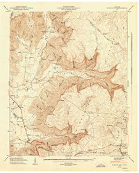
(11)- 1943 Map of Mc Minnville, 1944 Print
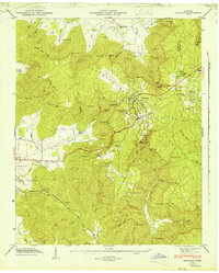
 1943 Mc Minnville1944 Print · USGSMid-Tennessee is captured here during the mobilization of the early 1940s, showing the vast Camp Forrest Military Reservation and thriving rail towns. Trace the N C & ST L line through Mcminnville or locate smaller rural hubs like Morrison and Hickerson Station.
 - 1946 Map of Savage Point
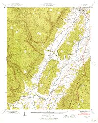
 1946 Savage Point1946 Print · USGSThe town of Dunlap and the surrounding heights of the Cumberland Plateau are captured here in the mid-1940s. Genealogists and historians can trace local landmarks like Sequatchie County High Sch, King Cem, and Cagle.4 unique versions available
 - 1946 Map of Sewanee, 1947 Print
 1946 Sewanee1947 Print · USGSSewanee and the surrounding plateau heights are captured here just after the war, showing the deep connection between the university and the mountain. Genealogists and historians can trace rail history at the Cowan Tunnel or locate family plots at Harrison Cem and St Marys Cem.4 unique versions available
 - 1946 Map of Daus, 1956 Print
 1946 Daus1956 Print · USGSThe Sequatchie Valley is captured just after the war as the mountain and valley economies intertwined. Genealogists and historians can trace family roots through numerous sites like Hatfield Cem, New Hope Ch, and the rail stops at Daus and Dunlap.6 unique versions available
 - 1947 Map of Daus
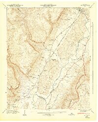 1947 Daus1947 Print · USGSThe Sequatchie Valley floor and the steep Cumberland Escarpment appear here just after the war, at a peak of rail-and-river connectivity. Researchers can trace family history through a dozen rural landmarks like Stone Cem, Cedar Spring Sch, and Daus.
 - 1947 Map of Burrow Cove, 1948 Print
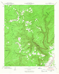
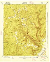
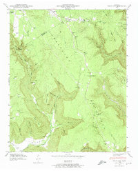
 1947 Burrow Cove1948 Print · USGSThe Grundy County uplands come alive in this post-war survey, showing the intricate relationship between the steep cove terrain and early valley settlements. Researchers can trace rural life through the many schools and cemeteries, from Wonder Cave and Payne Cove Sch to the Nashville Chattanooga and St Louis Railroad.7 unique versions available
 - 1947 Map of Savage Point, 1948 Print
 1947 Savage Point1948 Print · USGSThe Sequatchie Valley and Cumberland Plateau meet in this mid-century survey as the town of Dunlap begins its post-war growth. Researchers can trace rural lineages through sites like Lands Chapel, King Cem, and the Sequatchie County High Sch.
 - 1947 Map of Alto, 1948 Print
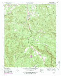
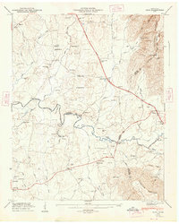 1947 Alto1948 Print · USGSThe Elk River valley at the foot of the Cumberland Escarpment was a network of close-knit farming communities in the late 1940s. Genealogists can trace family names through dozens of sites like Mt Pleasant Cem, Thompson Hall School, and Bells Mill.8 unique versions available
 - 1947 Map of Tracy City, 1974 Print
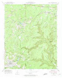 1947 Tracy City1974 Print · USGSThe Cumberland Plateau in the late 1940s was a landscape of deep coal mines and mountain settlements. Genealogists and historians can trace rail lines like the Nashville Chattanooga and St Louis and visit local landmarks like Orange Hill Ch or Bonnie Oak Cem.4 unique versions available
 - 1947 Map of White City, 1974 Print
 1947 White City1974 Print · USGSThe Cumberland Plateau of Marion and Grundy counties is captured here in the late 1940s, showing a rugged landscape of deep coves and ridge-top settlements. Genealogists and local historians can locate family landmarks like Sides Place, the Gregg Cem, and several rural schoolhouses such as Pryor Ridge Sch.4 unique versions available
 - 1947 Map of Palmer, 1983 Print
 1947 Palmer1983 Print · USGSThe Cumberland Plateau mining economy and mountain settlement patterns are documented here in the late 1940s. Genealogists can locate family landmarks like Layne Cem and industrial sites such as Palmer Mine and the Conveyor Belt.2 unique versions available
End of results
Showing maps 1-11 of 11
Top cities of Grundy County
- Gruetli-Laager historical maps
- Tracy City historical maps
- Altamont historical maps
- Coalmont historical maps
- Palmer historical maps
- Beersheba Springs historical maps
Frequently asked questions
- What are the different types of historical maps available for Grundy County?
- What is the oldest map of Grundy County?
- Where can I purchase historical maps of Grundy County for my home or office?
- Where can I download high-res historical maps of Grundy County?
- Are there historical topographic maps available for Grundy County?
- Is there historical aerial imagery available for Grundy County?
- Where are historical maps of Grundy County sourced from?