2020s Maps of Grundy County, Tennessee
Explore 17 historic maps of Grundy County from the 2020s. These maps offer a rare glimpse into what life looked like during the 2020s — showing old roads, neighborhoods, homes, and landmarks that have changed or disappeared over time.
Whether you're researching your family's past, planning a metal detecting trip, or studying how Grundy County's landscape evolved across the 2020s, these high-resolution maps are a powerful tool for exploring the history of this region.
- Focus on a specific era: All maps on this page are from the 2020s, giving you a focused view of this time period.
- See what’s changed: Compare century-old streets, trails, and buildings to today's modern landscape using overlays and satellite layers.
- Research with precision: Use these maps for genealogy, historical research, land use analysis, or educational projects.
- View, download, or print: Maps are fully viewable online in high resolution, and can be downloaded or printed for your own records.
Start exploring Grundy County's history through authentic maps from the 2020s. This is your window into the past.
Grundy County, TN maps
(17)- 2022 Map of Curtistown, 2022 Print
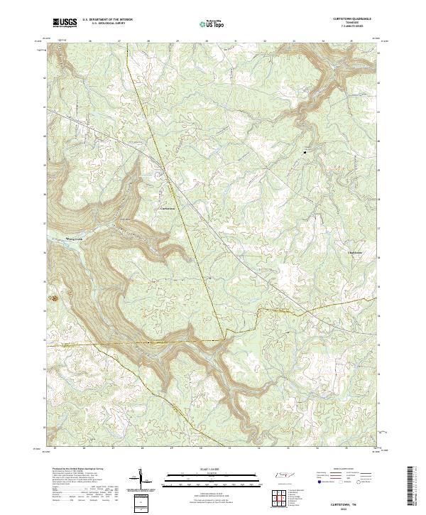 2022 Curtistown2022 Print · USGSThe Tennessee highlands near the junction of four counties are captured here in the early twenty-first century. Genealogists and local historians can trace family locations near Curtistown, the Pleasant Hill Cem, and the steep terrain of Dyer Gulch.
 - 2022 Map of Viola, 2022 Print
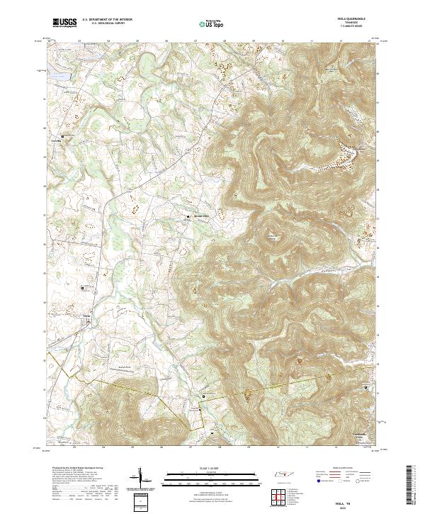 2022 Viola2022 Print · USGSThe Tennessee foothills near Viola and Vervilla are shown here as they appeared in 2022, where the landscape rises into the ridges of the Cumberland Plateau. Family historians can trace local roots through numerous burial grounds, including Northcutts Cove Cem and Macedonia Cem.
 - 2022 Map of Daus, 2022 Print
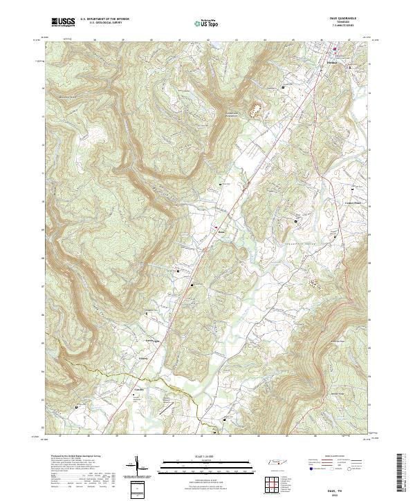 2022 Daus2022 Print · USGSThe Sequatchie Valley comes into focus in this recent survey, showing the corridor between the Cumberland Escarpment and Walden Ridge. Genealogists can locate family-named sites like Condra Memorial Cem, Cookston Cem, and the rural community of Daus.
 - 2022 Map of Hillsboro, 2022 Print
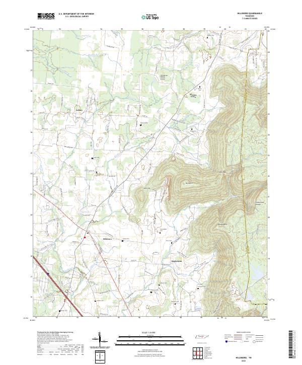 2022 Hillsboro2022 Print · USGSThe foothills of the Cumberland Plateau meet the valley floors of Coffee County in this detailed recent survey of the Tennessee landscape. Researchers can trace numerous family burial sites and rural communities, including Gentry Cem, Winton Town, and Stephenson.
 - 2022 Map of Cane Hollow, 2022 Print
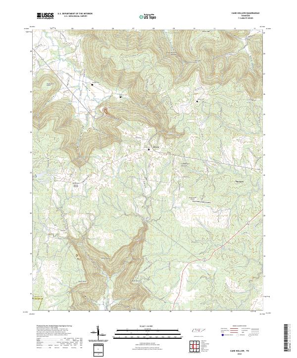 2022 Cane Hollow2022 Print · USGSThe Cumberland Plateau in Grundy County is shown here in the 2020s, highlighting the headwaters of the Elk River. Genealogists can locate family burial grounds like Wooten Cem and Johnny Cem or the community of Altamont.
 - 2022 Map of Irving College, 2022 Print
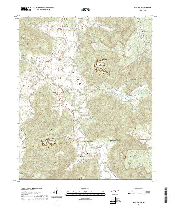 2022 Irving College2022 Print · USGSThe coves and ridges of Warren County are revealed in this modern survey of the Cumberland Plateau foothills. Researchers can locate family landmarks like Philadelphia Cem, the settlement of Irving College, and the heights of Ben Lomond Mtn.
 - 2022 Map of Altamont, 2022 Print
 2022 Altamont2022 Print · USGSThe Cumberland Plateau of Tennessee is captured here in the early twenty-first century, showing a landscape defined by deep coves and plateau-top towns. Genealogists and hikers can trace the paths to Stone Door, locate the Grundy County Courthouse, or find family plots at Swiss Colony Cem and Beersheba Springs Cem.
 - 2022 Map of Alto, 2022 Print
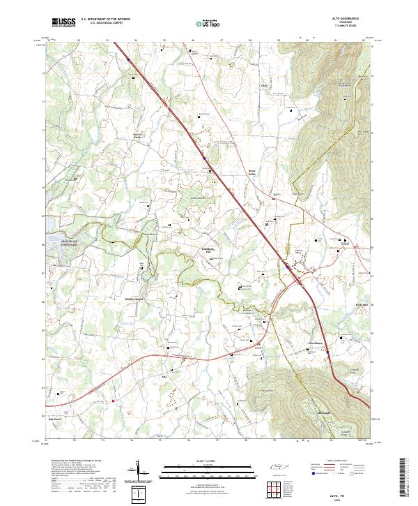 2022 Alto2022 Print · USGSThe Tennessee landscape south of the Highland Rim is captured here in the early twenty-first century, showing the rural communities of Prairie Plains and Pelham Valley. Genealogists can trace family heritage through dozens of local burial grounds like Alto Cem, Sherrill Cem, and Swann Cem.
 - 2022 Map of Morrison, 2022 Print
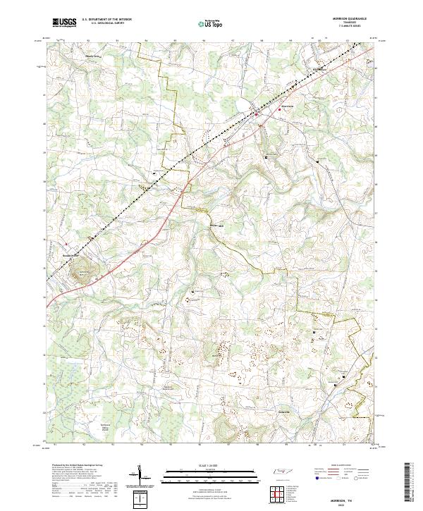 2022 Morrison2022 Print · USGSThe area around Morrison and Summitville is documented in this 2022 survey, showing the complex drainage along the Tennessee Valley Divide. Researchers can trace local lineage at Stroud Cem, Bryan Cem, or Cunningham Cem and locate landmarks like Bryan Mill.
 - 2022 Map of Burrow Cove, 2022 Print
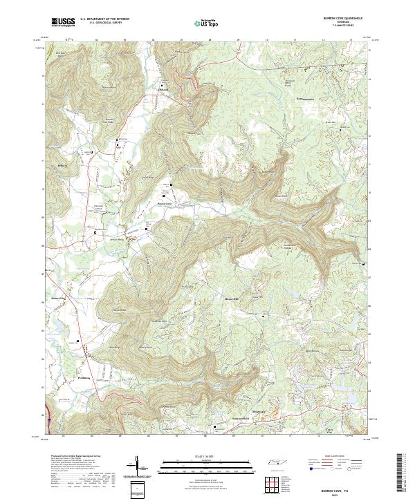 2022 Burrow Cove2022 Print · USGSThe Tennessee Cumberland Plateau at the start of the 2020s shows a landscape of deep coves and historic family settlements. Genealogists can trace rural ancestral roots through Bethel Cem, Campbell Cem, and the communities of Elkhead and Payne Cove.
 - 2022 Map of Tracy City, 2022 Print
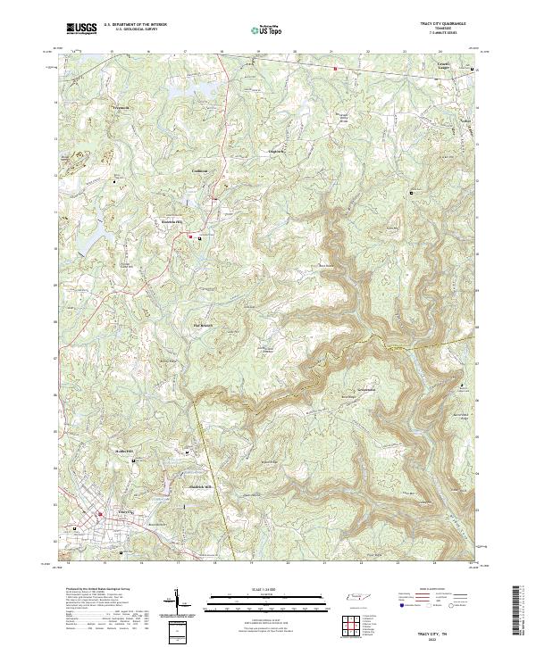 2022 Tracy City2022 Print · USGSSettled along the southern Cumberland Plateau, this portion of Grundy County reveals a landscape of ridge-top towns and deep gulfs. Genealogists can locate family names at Tracy City Cem or Coalmont Cem and trace the old routes through Black Bottom.
 - 2022 Map of Savage Point, 2022 Print
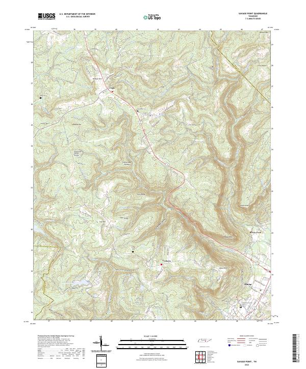 2022 Savage Point2022 Print · USGSThe rugged boundary between the plateau and the valley is captured here in the early twenty-first century. Genealogists and local historians can trace family locations near Lands Chapel, McGlothen Cem, and the old crossroads at Cagle or Fredonia.
 - 2022 Map of Collins, 2022 Print
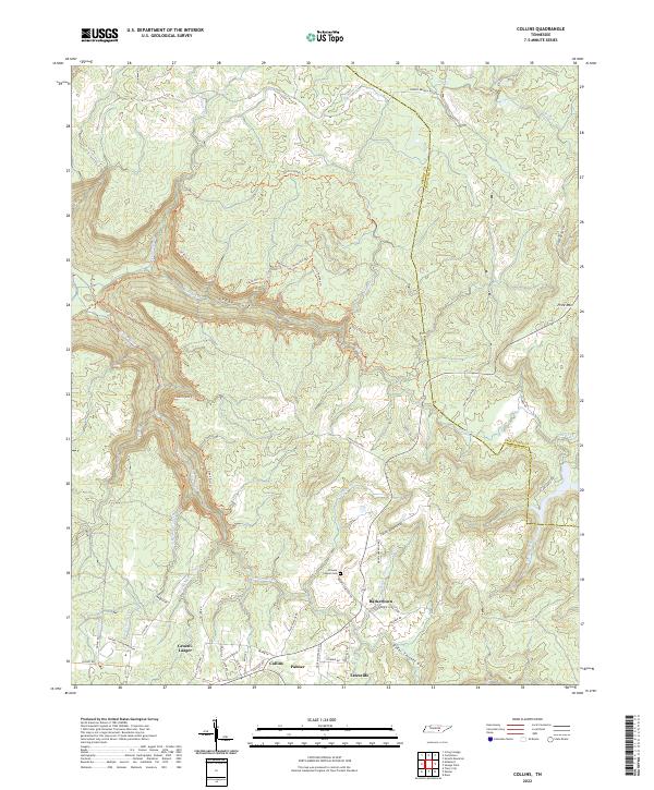 2022 Collins2022 Print · USGSThe Grundy County plateau is captured here in the early twenty-first century, showcasing the deep gorges and high ridges of the Cumberland Plateau. Genealogists and hikers can trace the roads around Gruetli-Laager or explore the wilderness trails near Savage Gulf and Browns Chapel Cem.
 - 2022 Map of Monteagle, 2022 Print
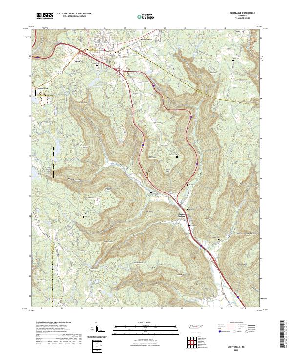 2022 Monteagle2022 Print · USGSThe heights of the Cumberland Plateau are captured here in the 2020s as transportation routes intersect at Monteagle. Researchers can trace family history through numerous rural burial sites like Lappin Cem and White Cem or locate landmarks like Sand Switch.
 - 2022 Map of Sewanee, 2022 Print
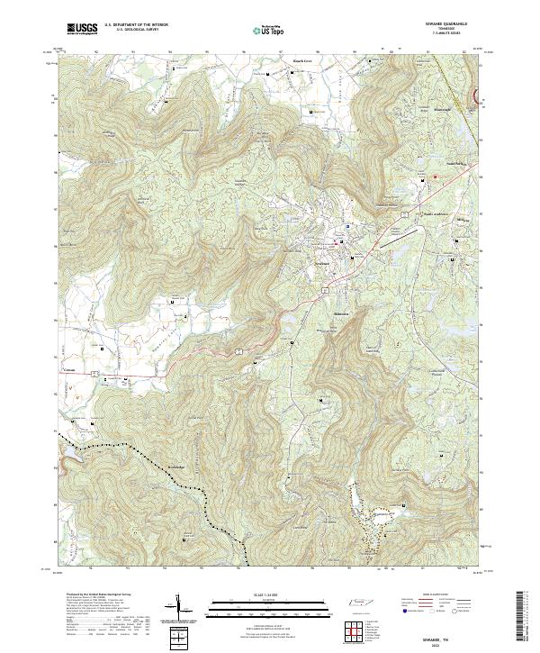 2022 Sewanee2022 Print · USGSThe Sewanee plateau and the Cumberland mountain country are mapped here in the early 2020s, showing the intersection of academic life and deep valley settlements. Researchers can locate University of the South landmarks alongside family sites like Sewell - Bowers Cem and the Natural Bridge.
 - 2022 Map of White City, 2022 Print
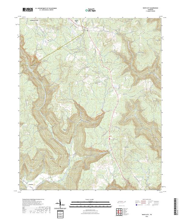 2022 White City2022 Print · USGSMarion and Grundy Counties are captured here in the 2020s, showing a landscape of high plateaus and deep coves. Researchers can locate Oak Grove Cem, trace the Old Stage Coach Rd, and explore the terrain around White City.
 - 2022 Map of Palmer, 2022 Print
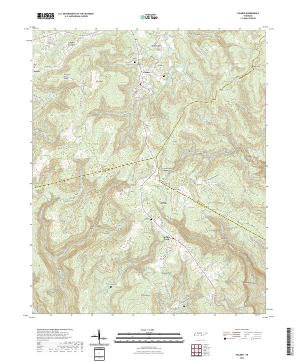 2022 Palmer2022 Print · USGSThe Cumberland Plateau terrain of Grundy County is captured here in the early twenty-first century, showing the distinct ridge-top settlements. Researchers can trace local lineage through Palmer City Cem and Layne Cem or explore the geography of Gruetli-Laager and Griffith Creek.
End of results
Showing maps 1-17 of 17
Top cities of Grundy County
- Gruetli-Laager historical maps
- Tracy City historical maps
- Altamont historical maps
- Coalmont historical maps
- Palmer historical maps
- Beersheba Springs historical maps
Frequently asked questions
- What are the different types of historical maps available for Grundy County?
- What is the oldest map of Grundy County?
- Where can I purchase historical maps of Grundy County for my home or office?
- Where can I download high-res historical maps of Grundy County?
- Are there historical topographic maps available for Grundy County?
- Is there historical aerial imagery available for Grundy County?
- Where are historical maps of Grundy County sourced from?