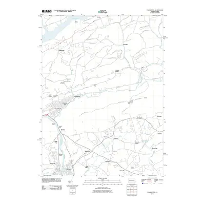
2010 Map of Palmerton
USGS Topo · Published 2010About this map
The Lehigh River carves a dramatic passage through the mountains at Lehigh Gap, a geographical focal point where river, rail, and road infrastructure converge. Along the eastern bank, the historic Lehigh Canal remains a visible marker of nineteenth-century transport, running parallel to the river toward Walnutport. The landscape is defined by the industrial and residential footprint of Palmerton, extending through Palmerton East to the smaller settlements of Aquashicola and Walkton along the Aquashicola Creek.
Find a feature on this map
113 named features on this map. Tap any name to fly to it.
Don’t see what you’re looking for? This feature index may not catch every label — zoom into the map to look around manually.
Map Details
Editions of this 2010 Palmerton Map
This is the sole edition of this map. No revisions or reprints were ever made.
Other maps of this area

1894 · Allentown
USGS Topo · 1:62,500

1902 · Slatington
USGS Topo · 1:62,500

1914 · Wind Gap
USGS Topo · 1:62,500

1916 · Wind Gap
USGS Topo · 1:62,500

1922 · Mauch Chunk
USGS Topo · 1:62,500

1924 · Mauch Chunk
USGS Topo · 1:62,500

1937 · Allentown West
USGS Topo · 1:48,000

1939 · Allentown
USGS Topo · 1:62,500

1942 · Allentown West
USGS Topo · 1:62,500

1943 · Mauch Chunk
USGS Topo · 1:62,500
Featured Places
- Palmerton, PA
- Walnutport, PA
- Cherryville, Lehigh Township
- Palmerton East, PA
- Welshtown, Washington Township