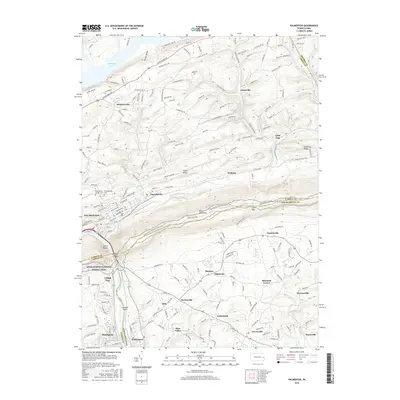
2016 Map of Palmerton
USGS Topo · Published 2016About this map
Lehigh Gap serves as the dramatic centerpiece of this region, where the Lehigh River cuts through the formidable ridge of Blue Mountain. The industrial character of the valley is anchored by Palmerton, established on the river's eastern bank, while the surrounding landscape transitions into a series of smaller residential pockets and agricultural corridors. Cultural and genealogy landmarks are well-represented by the Saint Johns Church Cem and Towamensing Cem, which preserve the early history of the local community.
Find a feature on this map
192 named features on this map. Tap any name to fly to it.
Don’t see what you’re looking for? This feature index may not catch every label — zoom into the map to look around manually.
Map Details
Editions of this 2016 Palmerton Map
This is the sole edition of this map. No revisions or reprints were ever made.
Other maps of this area

1894 · Allentown
USGS Topo · 1:62,500

1902 · Slatington
USGS Topo · 1:62,500

1914 · Wind Gap
USGS Topo · 1:62,500

1916 · Wind Gap
USGS Topo · 1:62,500

1922 · Mauch Chunk
USGS Topo · 1:62,500

1924 · Mauch Chunk
USGS Topo · 1:62,500

1937 · Allentown West
USGS Topo · 1:48,000

1939 · Allentown
USGS Topo · 1:62,500

1942 · Allentown West
USGS Topo · 1:62,500

1943 · Mauch Chunk
USGS Topo · 1:62,500
Featured Places
- Palmerton, PA
- Walnutport, PA
- Cherryville, Lehigh Township
- Palmerton East, PA
- Welshtown, Washington Township