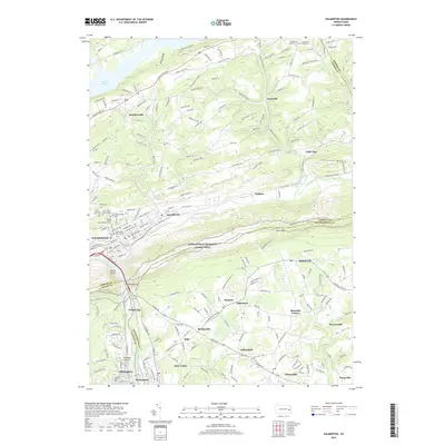
2019 Map of Palmerton
USGS Topo · Published 2019About this map
Palmerton stands at a significant geographic crossroads where the Lehigh River cuts through the mountains, a site marked by the dramatic Lehigh Gap and the geologic formation known as the Devils Pulpit. This 2019 survey documents a landscape defined by the intersection of three counties—Carbon, Lehigh, and Northampton—and the industrial and transit corridors that follow the river valley. The town of Palmerton itself is flanked by several significant religious and community landmarks, including Saint Johns Church Cem and Sacred Heart Roman Catholic Cem.
Find a feature on this map
53 named features on this map. Tap any name to fly to it.
Don’t see what you’re looking for? This feature index may not catch every label — zoom into the map to look around manually.
Map Details
Editions of this 2019 Palmerton Map
This is the sole edition of this map. No revisions or reprints were ever made.
Other maps of this area

1894 · Allentown
USGS Topo · 1:62,500

1902 · Slatington
USGS Topo · 1:62,500

1914 · Wind Gap
USGS Topo · 1:62,500

1916 · Wind Gap
USGS Topo · 1:62,500

1922 · Mauch Chunk
USGS Topo · 1:62,500

1924 · Mauch Chunk
USGS Topo · 1:62,500

1937 · Allentown West
USGS Topo · 1:48,000

1939 · Allentown
USGS Topo · 1:62,500

1942 · Allentown West
USGS Topo · 1:62,500

1943 · Mauch Chunk
USGS Topo · 1:62,500
Featured Places
- Palmerton, PA
- Walnutport, PA
- Cherryville, Lehigh Township
- Palmerton East, PA
- Welshtown, Washington Township