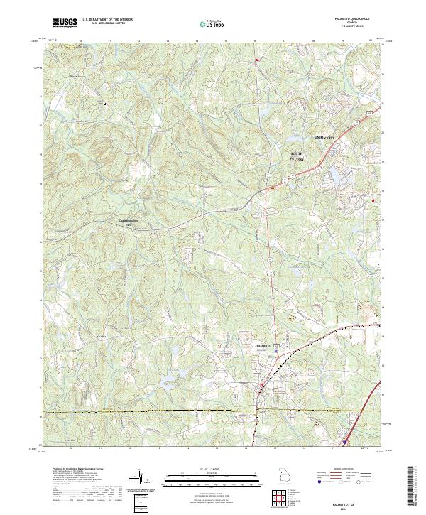
2024 Map of Palmetto
USGS Topo · Published 2024About this map
Palmetto and its surrounding countryside represent a modern view of the Georgia Piedmont, where the boundary between suburban expansion and rural heritage remains visible. The map details a landscape defined by its river-driven geography, anchored by the Chattahoochee Hills and the historic river crossing at Smith Ferry. While newer developments appear near Union City and South Fulton, the territory to the west retains its traditional character. This is evident in the survival of family-named landmarks and historical sites like the Cochran Cem near the settlement of Rivertown.
Find a feature on this map
141 named features on this map. Tap any name to fly to it.
Don’t see what you’re looking for? This feature index may not catch every label — zoom into the map to look around manually.
Map Details
Editions of this 2024 Palmetto Map
This is the sole edition of this map. No revisions or reprints were ever made.
Other maps of this area

1891 · Marietta
USGS Topo · 1:125,000

1895 · Marietta
USGS Topo · 1:125,000

1897 · Marietta
USGS Topo · 1:125,000

1901 · Marietta
USGS Topo · 1:125,000

1953 · Atlanta
USGS Topo · 1:250,000

1954 · Palmetto
USGS Topo · 1:24,000

1954 · Campbellton
USGS Topo · 1:24,000

1954 · Fairburn
USGS Topo · 1:24,000
1954 · Ben Hill
USGS Topo · 1:24,000

1957 · Atlanta
USGS Topo · 1:250,000