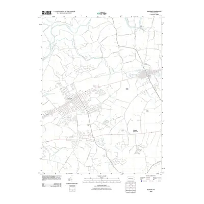
2010 Map of Palmyra
USGS Topo · Published 2010About this map
Palmyra serves as the central hub of this Pennsylvania landscape, where an extensive network of local roads and aviation infrastructure meet the winding waterways of the Susquehanna Valley. Small airfields like Millard Airport, Kruger Airport, and Reigle Field are interspersed among the town blocks and agricultural lands, highlighting the importance of regional general aviation. To the north and east, the hydrology is defined by the Swatara Creek and Quittapahilla Creek, with the Water Works Dam positioned near the northern boundary.
Find a feature on this map
69 named features on this map. Tap any name to fly to it.
Don’t see what you’re looking for? This feature index may not catch every label — zoom into the map to look around manually.
Map Details
Editions of this 2010 Palmyra Map
This is the sole edition of this map. No revisions or reprints were ever made.
Other maps of this area

1891 · Lebanon
USGS Topo · 1:62,500

1892 · Hummelstown
USGS Topo · 1:62,500

1893 · Lebanon
USGS Topo · 1:62,500

1899 · Lebanon
USGS Topo · 1:62,500

1902 · Lancaster
USGS Topo · 1:62,500

1904 · Lancaster
USGS Topo · 1:62,500

1908 · Middletown
USGS Topo · 1:62,500

1924 · Hummelstown
USGS Topo · 1:62,500
1943 · Lancaster
USGS Topo · 1:62,500
1943 · Lebanon
USGS Topo · 1:62,500
Featured Places
- Hershey, Derry Township
- Palmyra, PA
- Campbelltown, South Londonderry Township
- Annville, PA
- East Hanover Township, PA