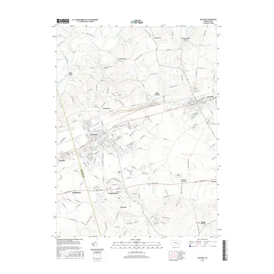
2016 Map of Palmyra
USGS Topo · Published 2016About this map
Palmyra and Hershey anchor this 2016 survey, which highlights the dense residential and commercial expansion along the corridor between Dauphin and Lebanon Counties. The terrain is defined by the winding course of Swatara Creek to the northwest and the Quittapahilla and Killinger creeks that drain the central valley. Small-scale aviation hubs like Reigle Field and Rover Airport sit amidst the suburban growth of Campbelltown and Palmdale.
Find a feature on this map
179 named features on this map. Tap any name to fly to it.
Don’t see what you’re looking for? This feature index may not catch every label — zoom into the map to look around manually.
Map Details
Editions of this 2016 Palmyra Map
This is the sole edition of this map. No revisions or reprints were ever made.
Other maps of this area

1891 · Lebanon
USGS Topo · 1:62,500

1892 · Hummelstown
USGS Topo · 1:62,500

1893 · Lebanon
USGS Topo · 1:62,500

1899 · Lebanon
USGS Topo · 1:62,500

1902 · Lancaster
USGS Topo · 1:62,500

1904 · Lancaster
USGS Topo · 1:62,500

1908 · Middletown
USGS Topo · 1:62,500

1924 · Hummelstown
USGS Topo · 1:62,500

1943 · Lancaster
USGS Topo · 1:62,500

1943 · Lebanon
USGS Topo · 1:62,500
Featured Places
- Hershey, Derry Township
- Palmyra, PA
- Campbelltown, South Londonderry Township
- Annville, PA
- East Hanover Township, PA