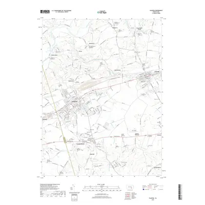
2019 Map of Palmyra
USGS Topo · Published 2019About this map
The borough of Palmyra and the surrounding Lebanon Valley landscape are meticulously detailed in this survey of the region south of Swatara Creek. This area, deeply rooted in Pennsylvania German heritage, shows a high density of small family and denominational burial grounds, including the Blauch Family Graveyard, Hershey Farm Cem, and the Christian Burckholder Graveyard. The town of Annville serves as an educational and cultural anchor for the eastern portion of the map, centered on the Lebanon Valley College campus.
Find a feature on this map
205 named features on this map. Tap any name to fly to it.
Don’t see what you’re looking for? This feature index may not catch every label — zoom into the map to look around manually.
Map Details
Editions of this 2019 Palmyra Map
This is the sole edition of this map. No revisions or reprints were ever made.
Other maps of this area

1891 · Lebanon
USGS Topo · 1:62,500

1892 · Hummelstown
USGS Topo · 1:62,500

1893 · Lebanon
USGS Topo · 1:62,500

1899 · Lebanon
USGS Topo · 1:62,500

1902 · Lancaster
USGS Topo · 1:62,500

1904 · Lancaster
USGS Topo · 1:62,500

1908 · Middletown
USGS Topo · 1:62,500

1924 · Hummelstown
USGS Topo · 1:62,500

1943 · Lancaster
USGS Topo · 1:62,500

1943 · Lebanon
USGS Topo · 1:62,500
Featured Places
- Hershey, Derry Township
- Palmyra, PA
- Campbelltown, South Londonderry Township
- Annville, PA
- East Hanover Township, PA