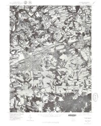
1977 Map of Palmyra
USGS Topo · Published 1979About this map
Palmyra and the surrounding Lebanon County agricultural landscape are captured in high detail through this 1977 orthophotograph. The settlement pattern reveals the concentrated development of Palmdale and the historical village of Campbelltown along the east-west transportation corridors. This specific aerial perspective, produced in cooperation with the Soil Conservation Service, highlights the sophisticated contour farming and strip-cropping practices that define the rural areas between Swatara Creek and Quittapahilla Creek. To the north, the small community of Bellegrove sits amidst a patchwork of fields, while the southern edge of the quadrangle rises toward the prominent elevation of Mount Wilson. The map provides an overhead view of Pennsylvania's transition from small-town centers to intensive dairy and crop production during the late 1970s.
Find a feature on this map
7 named features on this map. Tap any name to fly to it.
Don’t see what you’re looking for? This feature index may not catch every label — zoom into the map to look around manually.
Map Details
Editions of this 1977 Palmyra Map
This is the sole edition of this map. No revisions or reprints were ever made.
Other maps of this area

1891 · Lebanon
USGS Topo · 1:62,500

1892 · Hummelstown
USGS Topo · 1:62,500

1893 · Lebanon
USGS Topo · 1:62,500

1899 · Lebanon
USGS Topo · 1:62,500

1902 · Lancaster
USGS Topo · 1:62,500

1904 · Lancaster
USGS Topo · 1:62,500

1908 · Middletown
USGS Topo · 1:62,500

1924 · Hummelstown
USGS Topo · 1:62,500

1943 · Lancaster
USGS Topo · 1:62,500

1943 · Lebanon
USGS Topo · 1:62,500
Featured Places
- Hershey, Derry Township
- Palmyra, PA
- Campbelltown, South Londonderry Township
- Annville, PA
- East Hanover Township, PA