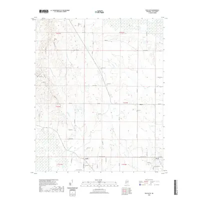
2020 Map of Palo Alto
USGS Topo · Published 2020About this map
Abbott and Griffith anchor this section of Clay County, where the landscape is defined by the headwaters and tributaries of several prominent drainage systems. The northern reaches are marked by the wetlands surrounding Houlka Cr, while Sand Cr and Underwood Cr carve through the western and central portions. The network of local roads, such as Palo Alto Rd and Old Hwy 47, connects small crossroads communities and scattered homesteads, reflecting a long-standing agricultural pattern.
Find a feature on this map
62 named features on this map. Tap any name to fly to it.
Don’t see what you’re looking for? This feature index may not catch every label — zoom into the map to look around manually.
Map Details
Editions of this 2020 Palo Alto Map
This is the sole edition of this map. No revisions or reprints were ever made.
Other maps of this area

1953 · West Point
USGS Topo · 1:250,000

1958 · West Point
USGS Topo · 1:250,000

1959 · West Point
USGS Topo · 1:62,500

1959 · Van Vleet
USGS Topo · 1:62,500

1959 · Pheba
USGS Topo · 1:62,500

1963 · West Point
USGS Topo · 1:250,000

1966 · Prairie
USGS Topo · 1:24,000

1982 · West Point
USGS Topo · 1:100,000

1984 · West Point
USGS Topo · 1:250,000
1987 · Cedar Bluff
USGS Topo · 1:24,000