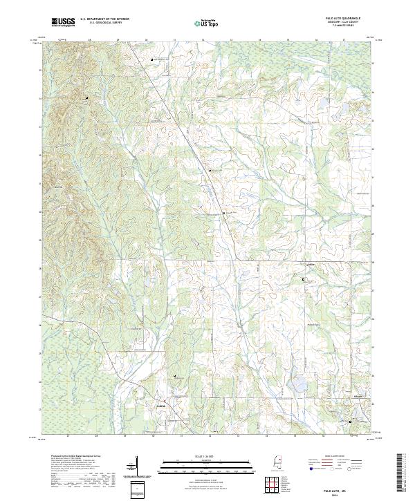
2024 Map of Palo Alto
USGS Topo · Published 2024About this map
Abbott and Siloam anchor this rural landscape in Clay County, where the topography is defined by the winding paths of Houlka Creek and Line Creek. The area maintains a traditional settlement pattern, with small clusters like Griffith and McBees Ferry connected by a network of family-named roads such as Buster Goode Rd and Jim Allen Blake Rd. Genealogists will find significant value in the numerous burial grounds documented here, including Saint Robertson Cem, Palo Alto Cem, and Rocky Hill Cem. The terrain rises at Reid Hill while lower elevations are marked by seasonal waterways like Death Creek and Long Branch, illustrating the drainage system of the Mississippi Black Prairie region. The inclusion of Deans Lake and various old farm-to-market routes preserves a clear picture of local land use and communal heritage.
Find a feature on this map
65 named features on this map. Tap any name to fly to it.
Don’t see what you’re looking for? This feature index may not catch every label — zoom into the map to look around manually.
Map Details
Editions of this 2024 Palo Alto Map
This is the sole edition of this map. No revisions or reprints were ever made.
Other maps of this area

1953 · West Point
USGS Topo · 1:250,000

1958 · West Point
USGS Topo · 1:250,000

1959 · West Point
USGS Topo · 1:62,500

1959 · Van Vleet
USGS Topo · 1:62,500

1959 · Pheba
USGS Topo · 1:62,500

1963 · West Point
USGS Topo · 1:250,000

1966 · Prairie
USGS Topo · 1:24,000

1982 · West Point
USGS Topo · 1:100,000

1984 · West Point
USGS Topo · 1:250,000
1987 · Cedar Bluff
USGS Topo · 1:24,000