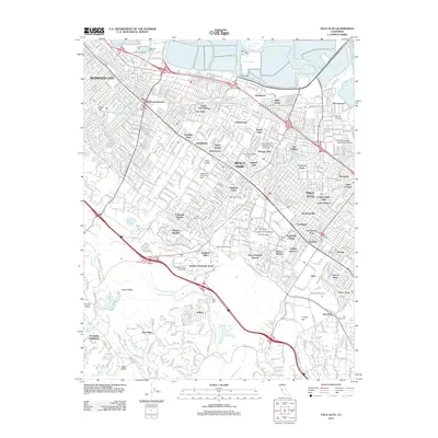
2012 Map of Palo Alto
USGS Topo · Published 2012About this map
Stanford University anchors the central landscape of this Peninsula survey, surrounded by established residential neighborhoods and significant academic and research institutions. The campus layout is clearly defined, featuring The Oval, The Quadrangle, and the Stanford Golf Course, while the Stanford Linear Accelerator extends to the west. This era shows a densely developed corridor stretching from Redwood City through Menlo Park and into Palo Alto, marked by diverse districts like Professorville, Lloyden Park, and Belle Haven.
Find a feature on this map
81 named features on this map. Tap any name to fly to it.
Don’t see what you’re looking for? This feature index may not catch every label — zoom into the map to look around manually.
Map Details
Editions of this 2012 Palo Alto Map
This is the sole edition of this map. No revisions or reprints were ever made.
Other maps of this area

1892 · San Mateo
USGS Topo · 1:62,500

1896 · San Mateo
USGS Topo · 1:62,500

1897 · Palo Alto
USGS Topo · 1:62,500

1899 · Palo Alto
USGS Topo · 1:62,500

1899 · Haywards
USGS Topo · 1:62,500

1899 · San Mateo
USGS Topo · 1:62,500

1902 · Santa Cruz
USGS Topo · 1:125,000

1915 · San Mateo
USGS Topo · 1:62,500

1915 · Haywards
USGS Topo · 1:62,500

1939 · San Mateo
USGS Topo · 1:62,500