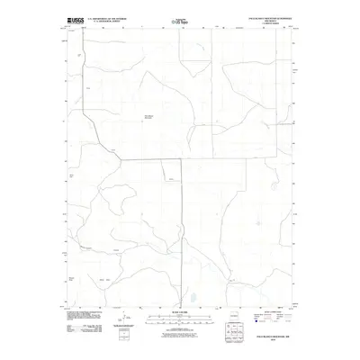
2010 Map of Palo Blanco Mountain
USGS Topo · Published 2010About this map
Palo Blanco Mountain dominates this portion of Union County, anchoring a landscape defined by high plains and drainage systems. This 2010 survey illustrates a sparse settlement pattern characterized by small, isolated locales like Castillo, Torres, and Hennegan. These points, along with Christmas and Favor, appear as modest hubs within a network of rural routes such as County Road A 57 and County Hwy A-044.
Find a feature on this map
20 named features on this map. Tap any name to fly to it.
Don’t see what you’re looking for? This feature index may not catch every label — zoom into the map to look around manually.
Map Details
Editions of this 2010 Palo Blanco Mountain Map
This is the sole edition of this map. No revisions or reprints were ever made.
Other maps of this area

1954 · Raton
USGS Topo · 1:250,000

1954 · Dalhart
USGS Topo · 1:250,000

1958 · Raton
USGS Topo · 1:250,000

1958 · Dalhart
USGS Topo · 1:250,000

1962 · Dalhart
USGS Topo · 1:250,000

1971 · Kiowa
USGS Topo · 1:24,000

1971 · Pine Buttes
USGS Topo · 1:24,000

1971 · Palo Blanco Mountain
USGS Topo · 1:24,000
1971 · Mesa Larga
USGS Topo · 1:24,000

1972 · Capulin
USGS Topo · 1:24,000