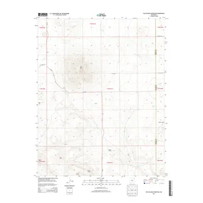
2013 Map of Palo Blanco Mountain
USGS Topo · Published 2013About this map
Palo Blanco Mtn anchors this northeastern New Mexico landscape, a prominent volcanic feature surrounded by the expansive drainage networks of Carrizo Cr and Palo Blanco Cr. In the early 21st century, the area remains defined by isolated settlements and ranching outposts like DeDay, Torres, and Castillo situated along the route of NM-193. The map documents a terrain marked by deep erosional cuts including Alamo Canyon and Torcido Canyon, leading toward the Chico Hills in the southwest.
Find a feature on this map
35 named features on this map. Tap any name to fly to it.
Don’t see what you’re looking for? This feature index may not catch every label — zoom into the map to look around manually.
Map Details
Editions of this 2013 Palo Blanco Mountain Map
This is the sole edition of this map. No revisions or reprints were ever made.
Other maps of this area

1954 · Raton
USGS Topo · 1:250,000

1954 · Dalhart
USGS Topo · 1:250,000

1958 · Raton
USGS Topo · 1:250,000

1958 · Dalhart
USGS Topo · 1:250,000

1962 · Dalhart
USGS Topo · 1:250,000

1971 · Kiowa
USGS Topo · 1:24,000

1971 · Pine Buttes
USGS Topo · 1:24,000

1971 · Palo Blanco Mountain
USGS Topo · 1:24,000
1971 · Mesa Larga
USGS Topo · 1:24,000

1972 · Capulin
USGS Topo · 1:24,000