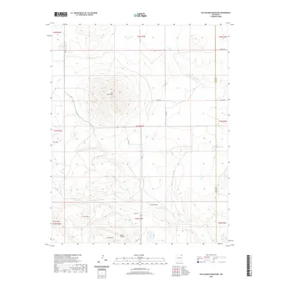
2020 Map of Palo Blanco Mountain
USGS Topo · Published 2020About this map
Palo Blanco Mtn anchors this high-plains landscape where the borders of Union and Colfax counties meet. The terrain is defined by a series of volcanic peaks and distinct topographical features such as Rincon Peak and the Chico Hills, which overlook a network of seasonal watercourses. Drainage systems like Carrizo Cr and Palo Blanco Cr carve through the land, creating named passages including Alamo Canyon and Torcido Canyon. Sparse human infrastructure consists primarily of ranch roads, such as Kennedy Rd and Carrico Rd, which navigate the sections of the Public Land Survey System. The presence of Alamo Spring and Barela Lake indicates the critical importance of water sources in this arid region of northeast New Mexico.
Find a feature on this map
30 named features on this map. Tap any name to fly to it.
Don’t see what you’re looking for? This feature index may not catch every label — zoom into the map to look around manually.
Map Details
Editions of this 2020 Palo Blanco Mountain Map
This is the sole edition of this map. No revisions or reprints were ever made.
Other maps of this area

1954 · Raton
USGS Topo · 1:250,000

1954 · Dalhart
USGS Topo · 1:250,000

1958 · Raton
USGS Topo · 1:250,000

1958 · Dalhart
USGS Topo · 1:250,000

1962 · Dalhart
USGS Topo · 1:250,000

1971 · Kiowa
USGS Topo · 1:24,000

1971 · Pine Buttes
USGS Topo · 1:24,000

1971 · Palo Blanco Mountain
USGS Topo · 1:24,000
1971 · Mesa Larga
USGS Topo · 1:24,000

1972 · Capulin
USGS Topo · 1:24,000