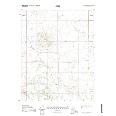
2023 Map of Palo Blanco Mountain
USGS Topo · Published 2023About this map
Palo Blanco Mountain dominates this northeastern New Mexico landscape, serving as a primary topographical anchor for the surrounding high plains. The drainage systems of Carrizo Creek and Palo Blanco Creek define the local hydrology, carving through the terrain alongside features like Laird Canyon and Torcido Canyon. For those researching local history, the Palo Blanco Cem near the southern boundary provides a specific point of interest for genealogical study. The map also delineates the jurisdictional boundary between Colfax Co and Union Co, which runs north-south through the eastern portion of the sheet. The sparse distribution of named roads, such as Yucca Rd and Kennedy Rd, reflects the ranching character of this region, where water sources like Alamo Spring and Barela Lake were essential for sustaining early land use.
Find a feature on this map
30 named features on this map. Tap any name to fly to it.
Don’t see what you’re looking for? This feature index may not catch every label — zoom into the map to look around manually.
Map Details
Editions of this 2023 Palo Blanco Mountain Map
This is the sole edition of this map. No revisions or reprints were ever made.
Other maps of this area

1954 · Raton
USGS Topo · 1:250,000

1954 · Dalhart
USGS Topo · 1:250,000

1958 · Raton
USGS Topo · 1:250,000

1958 · Dalhart
USGS Topo · 1:250,000

1962 · Dalhart
USGS Topo · 1:250,000

1971 · Kiowa
USGS Topo · 1:24,000

1971 · Pine Buttes
USGS Topo · 1:24,000

1971 · Palo Blanco Mountain
USGS Topo · 1:24,000
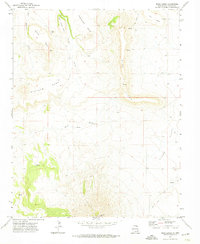
1971 · Mesa Larga
USGS Topo · 1:24,000

1972 · Capulin
USGS Topo · 1:24,000