
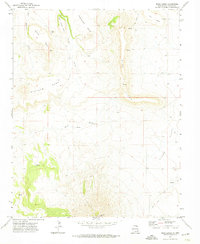
1971 Map of Palo Blanco Mountain
USGS Topo · Published 1974About this map
Palo Blanco Mountain dominates the landscape of north-central New Mexico in this early 1970s survey. The terrain is defined by a series of volcanic peaks and ridges including Cook Hill, Wire Hill, and the Chico Hills, which overlook the headwaters of numerous seasonal drainages. Local activity is sparse and concentrated around established water sources, as seen at Alamo Spring and Barela Lake.
Find a feature on this map
16 named features on this map. Tap any name to fly to it.
Don’t see what you’re looking for? This feature index may not catch every label — zoom into the map to look around manually.
Map Details
Editions of this 1971 Palo Blanco Mountain Map
This is the sole edition of this map. No revisions or reprints were ever made.
Other maps of this area

1954 · Raton
USGS Topo · 1:250,000

1954 · Dalhart
USGS Topo · 1:250,000

1958 · Raton
USGS Topo · 1:250,000

1958 · Dalhart
USGS Topo · 1:250,000

1962 · Dalhart
USGS Topo · 1:250,000

1971 · Kiowa
USGS Topo · 1:24,000

1971 · Pine Buttes
USGS Topo · 1:24,000
1971 · Mesa Larga
USGS Topo · 1:24,000

1972 · Capulin
USGS Topo · 1:24,000

1972 · Malpie Mountain
USGS Topo · 1:24,000