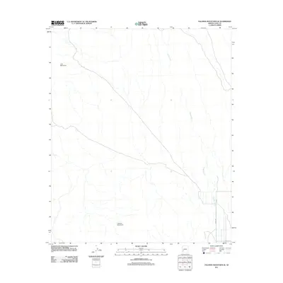
2011 Map of Palomas Mountains SE
USGS Topo · Published 2011About this map
Palomas Mountains and the Tank Mountains dominate this arid landscape in Yuma County, marking the transition between rugged desert ranges and the sprawling drainage systems of the southwest. The terrain is defined by the braided path of Hoodoo Wash, which flows southward through the quadrangle, carving a wide alluvial channel across the desert floor. Unlike more urbanized areas, this region exhibits a sparse infrastructure concentrated in the southeast corner. Here, the rectilinear grid of Avenue 66E and Co 13th St N indicates the fringes of local development and water management, where desert hydrology meets the edges of human settlement.
Find a feature on this map
5 named features on this map. Tap any name to fly to it.
Don’t see what you’re looking for? This feature index may not catch every label — zoom into the map to look around manually.
Map Details
Editions of this 2011 Palomas Mountains SE Map
This is the sole edition of this map. No revisions or reprints were ever made.
Other maps of this area

1927 · Hyder
USGS Topo · 1:62,500

1929 · Aztec
USGS Topo · 1:62,500

1930 · Stoval
USGS Topo · 1:62,500

1930 · Hyder
USGS Topo · 1:62,500

1942 · Vicksburg
USGS Topo · 1:250,000

1950 · Stoval
USGS Topo · 1:62,500

1950 · Aztec
USGS Topo · 1:62,500

1953 · Ajo
USGS Topo · 1:250,000

1954 · Phoenix
USGS Topo · 1:250,000

1957 · Ajo
USGS Topo · 1:250,000