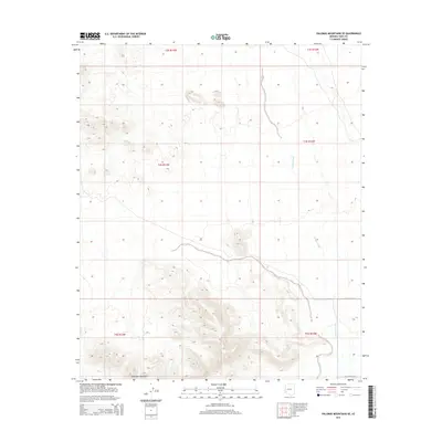
2014 Map of Palomas Mountains SE
USGS Topo · Published 2014About this map
Palomas Mountains anchor the southern reaches of this arid landscape in Yuma County, defined by a complex network of ephemeral drainage patterns. The most prominent of these is Hoodoo Wash, which threads northward through the eastern sections of the quadrangle. This 2014 survey captures a largely undeveloped desert expanse, where the natural topography dictates the few signs of human transit. The presence of E Co 13th St N at the southern and eastern margins highlights the grid-based road system that skirts the foothills. This map is particularly useful for understanding the hydrologic features and contour variations within the Palomas Mountains during the early 21st century, illustrating how water and relief shape the Sonoran Desert environment.
Find a feature on this map
9 named features on this map. Tap any name to fly to it.
Don’t see what you’re looking for? This feature index may not catch every label — zoom into the map to look around manually.
Map Details
Editions of this 2014 Palomas Mountains SE Map
This is the sole edition of this map. No revisions or reprints were ever made.
Other maps of this area

1927 · Hyder
USGS Topo · 1:62,500

1929 · Aztec
USGS Topo · 1:62,500

1930 · Stoval
USGS Topo · 1:62,500

1930 · Hyder
USGS Topo · 1:62,500

1942 · Vicksburg
USGS Topo · 1:250,000

1950 · Stoval
USGS Topo · 1:62,500

1950 · Aztec
USGS Topo · 1:62,500

1953 · Ajo
USGS Topo · 1:250,000

1954 · Phoenix
USGS Topo · 1:250,000

1957 · Ajo
USGS Topo · 1:250,000