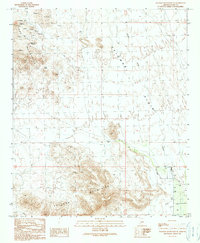
1990 Map of Palomas Mountains SE
USGS Topo · Published 1990About this map
Tank Mountains and the Palomas Mountains anchor this arid landscape in Yuma County, illustrating the resource extraction and desert management of the late 20th century. The northwestern corner is densely marked by mining activity, including numerous prospects, mine shafts, and an adit, indicating a history of exploration for minerals among the peaks. These industrial markings contrast with the open expanse of the Palomas Plain, which dominates the central portion of the quadrangle.
Find a feature on this map
19 named features on this map. Tap any name to fly to it.
Don’t see what you’re looking for? This feature index may not catch every label — zoom into the map to look around manually.
Map Details
Editions of this 1990 Palomas Mountains SE Map
This is the sole edition of this map. No revisions or reprints were ever made.
Other maps of this area

1927 · Hyder
USGS Topo · 1:62,500

1929 · Aztec
USGS Topo · 1:62,500

1930 · Stoval
USGS Topo · 1:62,500

1930 · Hyder
USGS Topo · 1:62,500

1942 · Vicksburg
USGS Topo · 1:250,000

1950 · Stoval
USGS Topo · 1:62,500

1950 · Aztec
USGS Topo · 1:62,500

1953 · Ajo
USGS Topo · 1:250,000

1954 · Phoenix
USGS Topo · 1:250,000

1957 · Ajo
USGS Topo · 1:250,000