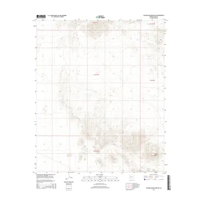
2014 Map of Palomas Mountains SW
USGS Topo · Published 2014About this map
Palomas Mountains define the physical and cultural geography of this Yuma County landscape, shown here through high-resolution topography and land survey data. The map provides a technical view of the southwestern portion of the range, dominated by steep elevation changes and the desert drainage systems that have shaped the region's accessibility. The sheet is organized by the Public Land Survey System, illustrating the townships and ranges of t3s r14w, t4s r14w, and t5s r14w alongside their eastern neighbors. These surveyed boundaries are essential for researchers tracing land ownership or historical desert travel routes within this specific segment of the Arizona desert.
Find a feature on this map
7 named features on this map. Tap any name to fly to it.
Don’t see what you’re looking for? This feature index may not catch every label — zoom into the map to look around manually.
Map Details
Editions of this 2014 Palomas Mountains SW Map
This is the sole edition of this map. No revisions or reprints were ever made.
Other maps of this area

1928 · Norton
USGS Topo · 1:62,500

1929 · Norton
USGS Topo · 1:62,500

1930 · Stoval
USGS Topo · 1:62,500

1942 · Vicksburg
USGS Topo · 1:250,000

1950 · Stoval
USGS Topo · 1:62,500

1953 · Ajo
USGS Topo · 1:250,000

1954 · Phoenix
USGS Topo · 1:250,000

1955 · Roll
USGS Topo · 1:62,500

1957 · Ajo
USGS Topo · 1:250,000

1957 · Phoenix
USGS Topo · 1:250,000