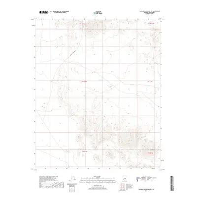
2018 Map of Palomas Mountains SW
USGS Topo · Published 2018About this map
The Palomas Mountains anchor the southeastern corner of this arid landscape in Yuma County. The terrain is defined by complex contour elevations that transition from the higher peaks in the south toward the broader flats to the northwest. A primary transportation artery, the Norton To Harquahala Rd, cuts across the northern half of the quadrangle, representing a vital historic desert crossing. This 2018 survey detail provides a clear look at the public land survey system grid, spanning several townships including t3s r14w and t5s r14w. The map emphasizes the isolation and topography of the region, where infrastructure is minimal and the natural landforms dictate the passage through this corner of the Arizona desert.
Find a feature on this map
8 named features on this map. Tap any name to fly to it.
Don’t see what you’re looking for? This feature index may not catch every label — zoom into the map to look around manually.
Map Details
Editions of this 2018 Palomas Mountains SW Map
This is the sole edition of this map. No revisions or reprints were ever made.
Other maps of this area

1928 · Norton
USGS Topo · 1:62,500

1929 · Norton
USGS Topo · 1:62,500

1930 · Stoval
USGS Topo · 1:62,500

1942 · Vicksburg
USGS Topo · 1:250,000

1950 · Stoval
USGS Topo · 1:62,500

1953 · Ajo
USGS Topo · 1:250,000

1954 · Phoenix
USGS Topo · 1:250,000

1955 · Roll
USGS Topo · 1:62,500

1957 · Ajo
USGS Topo · 1:250,000

1957 · Phoenix
USGS Topo · 1:250,000