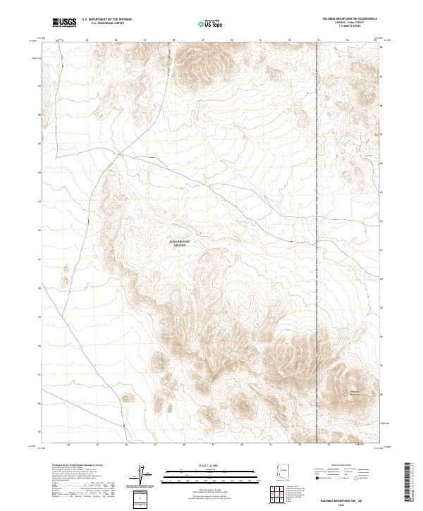
2021 Map of Palomas Mountains SW
USGS Topo · Published 2021About this map
Palomas Mountains anchor the southeastern corner of this region in Yuma County, their complex topography standing out against the surrounding desert floor. This 2021 survey reveals a landscape largely defined by the Public Land Survey System, with the vast grids of T4S R14W and t5s r13w mapping out the arid expanse. The map illustrates a network of unimproved roads and trails that traverse the open terrain, suggesting a remote area primarily accessible for geological study or land management rather than concentrated settlement. This visual record of the southwestern Arizona desert provides precise modern elevation data for the ridges and basins that characterize the Palomas Mountains range.
Find a feature on this map
7 named features on this map. Tap any name to fly to it.
Don’t see what you’re looking for? This feature index may not catch every label — zoom into the map to look around manually.
Map Details
Editions of this 2021 Palomas Mountains SW Map
This is the sole edition of this map. No revisions or reprints were ever made.
Other maps of this area

1928 · Norton
USGS Topo · 1:62,500

1929 · Norton
USGS Topo · 1:62,500

1930 · Stoval
USGS Topo · 1:62,500

1942 · Vicksburg
USGS Topo · 1:250,000

1950 · Stoval
USGS Topo · 1:62,500

1953 · Ajo
USGS Topo · 1:250,000

1954 · Phoenix
USGS Topo · 1:250,000

1955 · Roll
USGS Topo · 1:62,500

1957 · Ajo
USGS Topo · 1:250,000

1957 · Phoenix
USGS Topo · 1:250,000