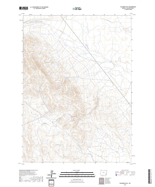
2023 Map of Palomino Hills
USGS Topo · Published 2023About this map
The Palomino Hills define this high-desert landscape in Malheur County, where a network of ephemeral drainages and modern water management features mark the terrain. This 2023 survey illustrates the complex hydrology of the region, featuring significant landmarks such as the Big Basin and numerous catchment sites including Two Bay Reservoir and Ridge End Reservoir. The map tracks the winding course of Palomino Creek and its namesake Palomino-Cr Reservoir in the northern reaches, transitioning toward Drought Creek in the south. This recent data from the U.S. Geological Survey offers a clear view of the existing infrastructure and topography, documenting the interplay between natural landforms like Scott Butte Creek and the man-made Lower Stockpile Reservoir used for local land management.
Find a feature on this map
14 named features on this map. Tap any name to fly to it.
Don’t see what you’re looking for? This feature index may not catch every label — zoom into the map to look around manually.
Map Details
Editions of this 2023 Palomino Hills Map
This is the sole edition of this map. No revisions or reprints were ever made.
Other maps of this area

1955 · Jordan Valley
USGS Topo · 1:250,000

1955 · Adel
USGS Topo · 1:250,000

1957 · Adel
USGS Topo · 1:250,000

1957 · Jordan Valley
USGS Topo · 1:250,000

1958 · Adel
USGS Topo · 1:250,000

1958 · Jordan Valley
USGS Topo · 1:250,000

1962 · Adel
USGS Topo · 1:250,000

1972 · Palomino Hills
USGS Topo · 1:24,000
1972 · Palomino Lake
USGS Topo · 1:24,000
1972 · Iron Mountain
USGS Topo · 1:24,000