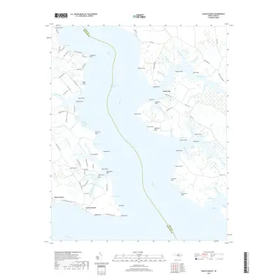
2019 Map of Pamlico Beach
USGS Topo · Published 2019About this map
The Pungo River and the Intracoastal Waterway define the water-bound character of this Beaufort County landscape, where the land fragments into numerous points and bays. Small settlements like Pamlico Beach and Makleyville are connected by a network of winding coastal roads such as Pamlico Beach Rd and Makleyville Rd. The topography is dominated by extensive wetland systems, most notably the One Thousand Marshes and Tarkiln Creek Bay.
Find a feature on this map
116 named features on this map. Tap any name to fly to it.
Don’t see what you’re looking for? This feature index may not catch every label — zoom into the map to look around manually.
Map Details
Editions of this 2019 Pamlico Beach Map
This is the sole edition of this map. No revisions or reprints were ever made.
Other maps of this area

1914 · Belhaven
USGS Topo · 1:48,000

1916 · Belhaven
USGS Topo · 1:62,500

1943 · Columbia
USGS Topo · 1:125,000

1943 · Plymouth
USGS Topo · 1:125,000

1950 · Lowland
USGS Topo · 1:24,000

1950 · South Creek
USGS Topo · 1:24,000

1951 · Pamlico Point
USGS Topo · 1:24,000

1951 · Ransomville
USGS Topo · 1:24,000

1951 · Pamlico Beach
USGS Topo · 1:24,000

1951 · Belhaven
USGS Topo · 1:24,000