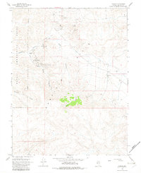
1967 Map of Pamlico
USGS Topo · Published 1982About this map
The Garfield Hills serve as the backdrop for an extensive mining history documented during this 1960s field check. Scattered across the arid landscape are the remnants of early 20th-century extraction, most notably at the Pamlico (Site) and La Panta (Site), where once-active communities supported the local gold and silver industry. The concentration of claims is dense throughout the central terrain, including the Pamlico Mines and La Panta Mine, alongside smaller operations like the Lazy Man Mine and Golden Bomber Mine. This survey captures a landscape in transition, where the historic mining canyon network—including Pamlico Canyon and Never Sweat Canyon—meets the modern expansion of the Naval Ammunition Depot along the western reservation boundary. The network of jeep trails provides the only access to these high-elevation prospects, illustrating the challenging geography encountered by Mineral County prospectors.
Find a feature on this map
25 named features on this map. Tap any name to fly to it.
Don’t see what you’re looking for? This feature index may not catch every label — zoom into the map to look around manually.
Map Details
Editions of this 1967 Pamlico Map
2 editions found
Other maps of this area

1909 · Hawthorne
USGS Topo · 1:250,000

1911 · Hawthorne
USGS Topo · 1:250,000

1915 · Hawthorne
USGS Topo · 1:250,000

1948 · Walker Lake
USGS Topo · 1:250,000

1955 · Powell Mtn
USGS Topo · 1:62,500

1955 · Hawthorne
USGS Topo · 1:62,500

1957 · Walker Lake
USGS Topo · 1:250,000

1962 · Walker Lake
USGS Topo · 1:250,000

1964 · Walker Lake
USGS Topo · 1:250,000

1967 · Pamlico
USGS Topo · 1:24,000