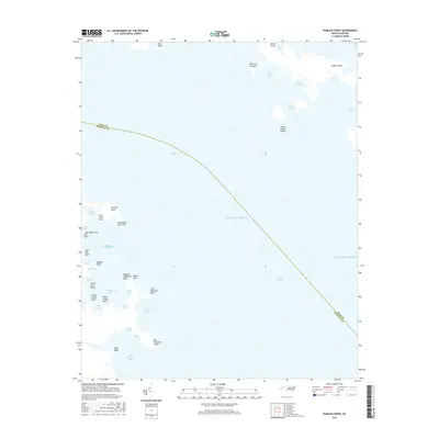
2016 Map of Pamlico Point
USGS Topo · Published 2016About this map
Judith Island and the intricate coastal wetlands of the Outer Banks dominate this transition zone where the land meets the Atlantic Ocean and Pamlico Sound. This maritime environment is defined by a complex network of bays and points that reveal the volatile nature of the North Carolina shoreline. The boundary between Hyde County and Pamlico County cuts diagonally through the waters, marking jurisdictional lines in a region shaped more by tides than by roads. Local history is etched into the names of small landforms like Shell Hill Point and Sage Point, while larger bodies of water such as Mouse Harbor and Deep Bay hint at the traditional fishing and trapping grounds important to the local economy. The geography here is almost entirely aquatic, with the low-lying Little Judith Islands and Judith Narrows serving as key markers for navigation through these shallow coastal reaches.
Find a feature on this map
43 named features on this map. Tap any name to fly to it.
Don’t see what you’re looking for? This feature index may not catch every label — zoom into the map to look around manually.
Map Details
Editions of this 2016 Pamlico Point Map
This is the sole edition of this map. No revisions or reprints were ever made.
Other maps of this area

1950 · Lowland
USGS Topo · 1:24,000

1950 · Jones Bay
USGS Topo · 1:24,000

1951 · Brant Island
USGS Topo · 1:24,000

1951 · Pamlico Point
USGS Topo · 1:24,000

1951 · Great Island
USGS Topo · 1:24,000

1951 · Pamlico Beach
USGS Topo · 1:24,000

1951 · Scranton
USGS Topo · 1:24,000

1951 · Swanquarter
USGS Topo · 1:24,000

1953 · Rocky Mount
USGS Topo · 1:250,000

1954 · Rocky Mount
USGS Topo · 1:250,000