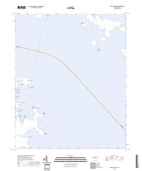
2022 Map of Pamlico Point
USGS Topo · Published 2022About this map
The vast confluence of the Pamlico River and Pamlico Sound dominates this coastal landscape, where the jagged shoreline of Hyde County meets the water through a series of named points and shallow coves. The map reveals an intricate network of maritime landmarks, from the northern reach of Deep Bay and Toler Bay down to the southern marshes of Big Porpoise Bay. The geography is defined by narrow passages and protective harbors, such as Judith Narrows and the sheltered Mouse Harbor.
Find a feature on this map
46 named features on this map. Tap any name to fly to it.
Don’t see what you’re looking for? This feature index may not catch every label — zoom into the map to look around manually.
Map Details
Editions of this 2022 Pamlico Point Map
This is the sole edition of this map. No revisions or reprints were ever made.
Other maps of this area

1950 · Lowland
USGS Topo · 1:24,000

1950 · Jones Bay
USGS Topo · 1:24,000

1951 · Brant Island
USGS Topo · 1:24,000

1951 · Pamlico Point
USGS Topo · 1:24,000

1951 · Great Island
USGS Topo · 1:24,000

1951 · Pamlico Beach
USGS Topo · 1:24,000

1951 · Scranton
USGS Topo · 1:24,000

1951 · Swanquarter
USGS Topo · 1:24,000

1953 · Rocky Mount
USGS Topo · 1:250,000

1954 · Rocky Mount
USGS Topo · 1:250,000