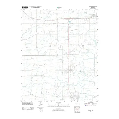
2010 Map of Panama
USGS Topo · Published 2010About this map
The town of Panama serves as the focal point of this Eastern Oklahoma landscape, situated where the Poteau River and James Fork converge amidst a dense network of country roads. The area's geography is defined by a complex hydraulic system including Brazil Creek, Buck Creek, and the winding Holi-Tuska Creek, which drains the terrain near Nubbin Ridge. These waterways and their associated basins suggest a history of agricultural and perhaps industrial utility, evidenced by the presence of Carter Lake and Swink Lake.
Find a feature on this map
46 named features on this map. Tap any name to fly to it.
Don’t see what you’re looking for? This feature index may not catch every label — zoom into the map to look around manually.
Map Details
Editions of this 2010 Panama Map
This is the sole edition of this map. No revisions or reprints were ever made.
Other maps of this area

1900 · Sallisaw
USGS Topo · 1:125,000

1911 · Sallisaw
USGS Topo · 1:125,000

1946 · Fort Smith
USGS Topo · 1:250,000

1965 · Fort Smith
USGS Topo · 1:250,000

1966 · Muldrow SW
USGS Topo · 1:24,000

1967 · Fort Smith
USGS Topo · 1:250,000

1967 · Robert S Kerr Dam
USGS Topo · 1:24,000
1967 · Fort Coffee
USGS Topo · 1:24,000
1968 · Spiro
USGS Topo · 1:24,000
1968 · Panama
USGS Topo · 1:24,000