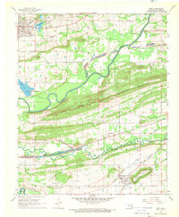
1968 Map of Spiro
USGS Topo · Published 1969About this map
Skullyville (Oak Lodge) and the northern edges of the San Bois and Ouachita foothills define this landscape in the late 1960s. The area is a nexus of transportation and extraction, where the Kansas City Southern and St Louis-San Francisco railroads intersect a terrain marked by extensive strip mines and gravel operations. The Poteau River winds through the center, separating the community of Spiro from the ridge of Backbone Mountain. Local life is anchored by numerous country congregations and burial grounds, including the New Hope Cem Ch and Royal Oak Ch. The map also captures infrastructure in transition, showing an Old Railroad Grade and new highway construction labeled Under Construction near Cameron, illustrating the shifting economic focus of Le Flore County as traditional mining and rail patterns evolved.
Find a feature on this map
46 named features on this map. Tap any name to fly to it.
Don’t see what you’re looking for? This feature index may not catch every label — zoom into the map to look around manually.
Map Details
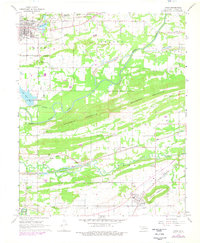
Editions of this 1968 Spiro Map
2 editions found
Other maps of this area

1879 · Fort Smith
USGS Topo · 1:62,500

1887 · Van Buren
USGS Topo · 1:62,500

1887 · Greenwood
USGS Topo · 1:62,500

1890 · Fort Smith
USGS Topo · 1:125,000

1900 · Sallisaw
USGS Topo · 1:125,000

1911 · Sallisaw
USGS Topo · 1:125,000

1943 · Fort Smith
USGS Topo · 1:125,000

1946 · Fort Smith
USGS Topo · 1:250,000

1947 · Van Buren
USGS Topo · 1:62,500

1947 · Greenwood
USGS Topo · 1:62,500