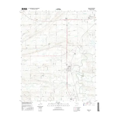
2016 Map of Panama
USGS Topo · Published 2016About this map
The winding Poteau River and the broad Poteau Valley dominate this survey of Le Flore County, where the landscape is defined by its transition from the heights of Nubbin Ridge to the alluvial lowlands. The settlement of Panama serves as a central hub, situated near the confluence of Buck Creek and Coal Creek. To the north, the town of Spiro borders the Garden of Memories Cemetery, while smaller rural locales like Ward, Bedwell, and Sunset Corner are scattered along a network of county roads such as Co Rd E1250. This era reveals a territory balancing agricultural land with numerous water bodies, including New Spiro Lake and Carter Lake. The map provides specific locations for local history researchers, noting the Fair View Cemetery and Nubbin Ridge Cemetery, which offer key markers of the area’s genealogical heritage.
Find a feature on this map
75 named features on this map. Tap any name to fly to it.
Don’t see what you’re looking for? This feature index may not catch every label — zoom into the map to look around manually.
Map Details
Editions of this 2016 Panama Map
This is the sole edition of this map. No revisions or reprints were ever made.
Other maps of this area

1900 · Sallisaw
USGS Topo · 1:125,000

1911 · Sallisaw
USGS Topo · 1:125,000

1946 · Fort Smith
USGS Topo · 1:250,000

1965 · Fort Smith
USGS Topo · 1:250,000

1966 · Muldrow SW
USGS Topo · 1:24,000

1967 · Fort Smith
USGS Topo · 1:250,000

1967 · Robert S Kerr Dam
USGS Topo · 1:24,000
1967 · Fort Coffee
USGS Topo · 1:24,000
1968 · Spiro
USGS Topo · 1:24,000
1968 · Panama
USGS Topo · 1:24,000