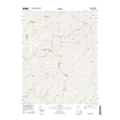
2014 Map of Panther
USGS Topo · Published 2014About this map
Panther sits at a major bend of the Tug Fork, serving as a primary point of settlement where the railroad follows the river through the steep valleys of the Cumberland Plateau. This 2014 survey documents a landscape defined by its deep hollows and high ridges, notably State Line Ridge, which forms the political boundary between McDowell County, West Virginia, and Buchanan County, Virginia. The region's genealogy is preserved in numerous family-named burial grounds tucked into nearly every drainage, such as Robertson Cem near Greenbrier Fork and Sullivan Cem to the north. Higher elevations are marked by landmarks like the Panther Lookout Tower, while the southern portion of the map shows the community of Blackey along the banks of Knox Creek. The intricate network of local roads like Johnny Cake Rd and Zacks Branch Rd reveals the persistent human footprint in this densely folded terrain.
Find a feature on this map
116 named features on this map. Tap any name to fly to it.
Don’t see what you’re looking for? This feature index may not catch every label — zoom into the map to look around manually.
Map Details
Editions of this 2014 Panther Map
This is the sole edition of this map. No revisions or reprints were ever made.
Other maps of this area

1886 · Grundy
USGS Topo · 1:125,000

1887 · Warfield
USGS Topo · 1:125,000

1890 · Grundy
USGS Topo · 1:125,000

1891 · Tazewell
USGS Topo · 1:125,000

1891 · Oceana
USGS Topo · 1:125,000

1891 · Warfield
USGS Topo · 1:125,000

1892 · Grundy
USGS Topo · 1:125,000

1893 · Oceana
USGS Topo · 1:125,000

1895 · Tazewell
USGS Topo · 1:125,000

1897 · Tazewell
USGS Topo · 1:125,000