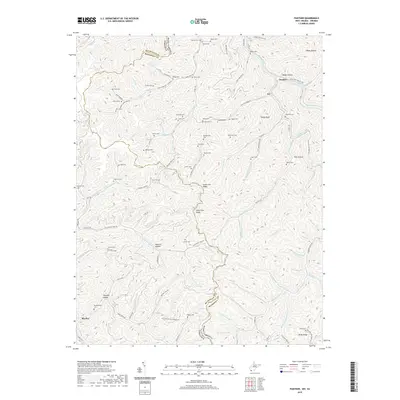
2019 Map of Panther
USGS Topo · Published 2019About this map
The borderlands of the Buchanan Co McDowell Co line define this area where the state boundaries of West Virginia Virginia meet. The settlement of Panther sits along the Tug Fork river, served by the Norfolk Southern railway, while the community of Blackey marks the southwestern edge of the survey. The landscape is characterized by a dense concentration of family cemeteries, including Sullivan Cem, Hunt Cem, and Lester Cem, reflecting a long history of kinship and small mountain settlements. High ridges like State Line Ridge and Estep Ridge separate the many hollows and forks, such as Wildcat Hollow and Thimble Hollow. These topographical features indicate a traditional Appalachian pattern of settlement where homes and roads followed the narrow valley floors of Panther Creek and its many tributaries.
Find a feature on this map
117 named features on this map. Tap any name to fly to it.
Don’t see what you’re looking for? This feature index may not catch every label — zoom into the map to look around manually.
Map Details
Editions of this 2019 Panther Map
This is the sole edition of this map. No revisions or reprints were ever made.
Other maps of this area

1886 · Grundy
USGS Topo · 1:125,000

1887 · Warfield
USGS Topo · 1:125,000

1890 · Grundy
USGS Topo · 1:125,000

1891 · Tazewell
USGS Topo · 1:125,000

1891 · Oceana
USGS Topo · 1:125,000

1891 · Warfield
USGS Topo · 1:125,000

1892 · Grundy
USGS Topo · 1:125,000

1893 · Oceana
USGS Topo · 1:125,000

1895 · Tazewell
USGS Topo · 1:125,000

1897 · Tazewell
USGS Topo · 1:125,000