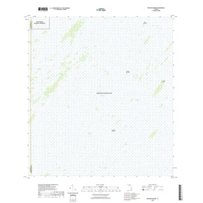
2018 Map of Panther Mound
USGS Topo · Published 2018About this map
Everglades National Park and the Big Cypress National Preserve converge on this sheet, documenting the intricate hydrology of southern Florida. The map illustrates a landscape dominated by the Shark River Slough, a primary drainage system within The Everglades. Because of the slight variations in elevation, distinctive hardwood hammocks emerge from the surrounding wetlands, providing critical dry ground. These features, including Pot Hammock, Guava Hammock, and Cane Mill Hammock, are often historic sites for human activity and ecological diversity in an otherwise fluid environment. The presence of Panther Mound suggests a point of higher relief that has long served as a landmark in the expansive river of grass. The boundary between Monroe County and Miami-Dade County runs vertically through the western portion of the preserve, marking a political division in this protected wilderness.
Find a feature on this map
9 named features on this map. Tap any name to fly to it.
Don’t see what you’re looking for? This feature index may not catch every label — zoom into the map to look around manually.
Map Details
Editions of this 2018 Panther Mound Map
This is the sole edition of this map. No revisions or reprints were ever made.
Other maps of this area

1956 · Miami
USGS Topo · 1:250,000

1958 · Miami
USGS Topo · 1:250,000

1972 · Shark Valley Lookout Tower
USGS Topo · 1:24,000

1972 · Lostmans Trail
USGS Topo · 1:24,000

1972 · Chekika Island
USGS Topo · 1:24,000

1972 · Long Pine Key
USGS Topo · 1:24,000

1972 · Panther Mound
USGS Topo · 1:24,000

1972 · Tarpon Bay
USGS Topo · 1:24,000

1972 · Indian Camp Creek
USGS Topo · 1:24,000

1972 · Pa Hay Okee Lookout Tower
USGS Topo · 1:24,000