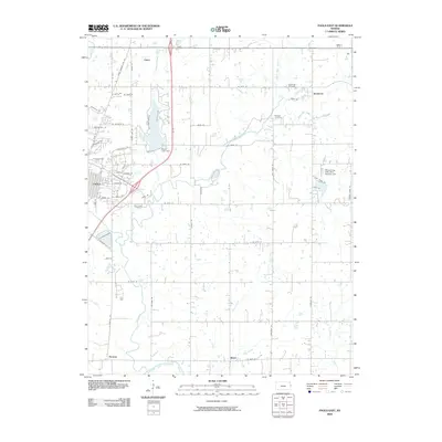
2009 Map of Paola East
USGS Topo · Published 2009About this map
Miola Lake serves as a central geographical landmark northeast of Paola, where the Miola Lake Dam regulates the surrounding watershed near Miola Lake Drive. This 2009 survey of Miami County documents a landscape defined by its tributary systems, notably South Wea Creek and the southern flow of the Marais Des Cygnes River near Henson. The settlement pattern reflects the agricultural roots of eastern Kansas, with small communities like Somerset and Block situated among numerous family and community landmarks. Genealogists will find significant value in the distribution of burial grounds across the quadrangle, including Somerset Cemetery, Hodges Cemetery, and Holy Cross Cemetery. The area's transition into the 21st century is visible in the network of rural roads and residential developments such as Whispering Oaks Dam Number One.
Find a feature on this map
63 named features on this map. Tap any name to fly to it.
Don’t see what you’re looking for? This feature index may not catch every label — zoom into the map to look around manually.
Map Details
Editions of this 2009 Paola East Map
This is the sole edition of this map. No revisions or reprints were ever made.
Other maps of this area

1887 · Olathe
USGS Topo · 1:125,000

1887 · Mound City
USGS Topo · 1:125,000

1893 · Mound City
USGS Topo · 1:125,000

1893 · Olathe
USGS Topo · 1:125,000

1947 · Lawrence
USGS Topo · 1:250,000

1950 · Lawrence
USGS Topo · 1:250,000

1956 · Bucyrus
USGS Topo · 1:24,000

1956 · Paola East
USGS Topo · 1:24,000

1956 · Lawrence
USGS Topo · 1:250,000
1957 · Paola West
USGS Topo · 1:24,000