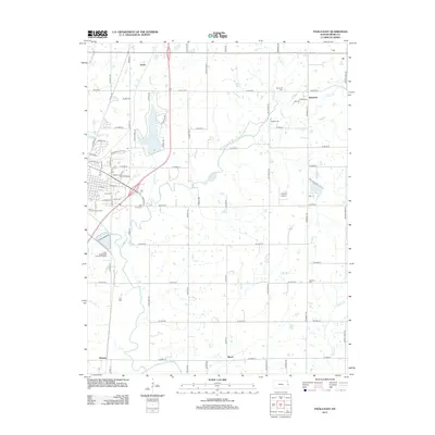
2012 Map of Paola East
USGS Topo · Published 2012About this map
Miola Lake serves as a prominent focal point for the rural landscape east of the county seat, surrounded by a grid of local roads and evolving residential pockets. The area is characterized by its agricultural roots and deep-seated local history, evidenced by the numerous burial grounds scattered across the township, including Somerset Cem, Hodges Cem, and Highland Cem. Small community clusters like Somerset and Lento maintain their identity along the country routes, while the southern boundary is defined by the winding course of the Marais des Cygnes River. Further north, the landscape is drained by tributaries such as Bull Cr and N Wea Cr. This 2012 survey captures the modern layout of the Miami County Fairgrounds and the infrastructure of the Paola Wastewater Treatment Facility, reflecting the balance between traditional Kansas farmland and necessary municipal growth.
Find a feature on this map
68 named features on this map. Tap any name to fly to it.
Don’t see what you’re looking for? This feature index may not catch every label — zoom into the map to look around manually.
Map Details
Editions of this 2012 Paola East Map
This is the sole edition of this map. No revisions or reprints were ever made.
Other maps of this area

1887 · Olathe
USGS Topo · 1:125,000

1887 · Mound City
USGS Topo · 1:125,000

1893 · Mound City
USGS Topo · 1:125,000

1893 · Olathe
USGS Topo · 1:125,000

1947 · Lawrence
USGS Topo · 1:250,000

1950 · Lawrence
USGS Topo · 1:250,000

1956 · Bucyrus
USGS Topo · 1:24,000

1956 · Paola East
USGS Topo · 1:24,000

1956 · Lawrence
USGS Topo · 1:250,000
1957 · Paola West
USGS Topo · 1:24,000