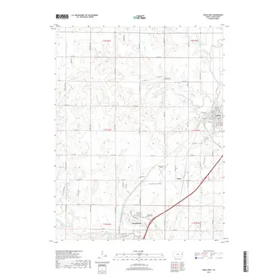
2018 Map of Paola West
USGS Topo · Published 2018About this map
Paola and Osawatomie anchor the eastern and southern edges of this landscape, where the prairie topography is defined by the winding course of the Marais des Cygnes River and its tributaries like Plum Creek and Walnut Creek. The survey captures a well-developed network of rural infrastructure, from the Miami County Airport to several significant burial grounds, including the Miami County Poor Farm Cemetery and the Osawatomie State Hospital Cemetery. These labels reflect the region's social and institutional history during the early 21st century. Settlement patterns follow a strict section-line road grid, yet the natural drainage of Bull Creek and McFadden Branch dictates the underlying shape of the terrain, carving out deep valleys between the elevated county roads.
Find a feature on this map
85 named features on this map. Tap any name to fly to it.
Don’t see what you’re looking for? This feature index may not catch every label — zoom into the map to look around manually.
Map Details
Editions of this 2018 Paola West Map
This is the sole edition of this map. No revisions or reprints were ever made.
Other maps of this area

1885 · Garnett
USGS Topo · 1:125,000

1885 · Lawrence
USGS Topo · 1:125,000

1887 · Olathe
USGS Topo · 1:125,000

1887 · Mound City
USGS Topo · 1:125,000

1889 · Lawrence
USGS Topo · 1:125,000

1893 · Mound City
USGS Topo · 1:125,000

1893 · Olathe
USGS Topo · 1:125,000

1894 · Garnett
USGS Topo · 1:125,000

1947 · Lawrence
USGS Topo · 1:250,000

1950 · Lawrence
USGS Topo · 1:250,000