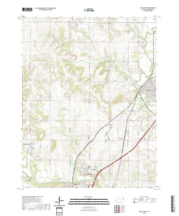
2022 Map of Paola West
USGS Topo · Published 2022About this map
The confluence of history and hydrology defines this landscape in Miami County, where Osawatomie and Paola serve as the primary hubs. The Marais des Cygnes River meanders across the southern portion of the sheet, a waterway that has historically dictated the settlement patterns and agricultural development of the region. Just north of the river, the Osawatomie State Hospital Cem and Oakwood Cem provide significant touchpoints for genealogical research, while the presence of the Miami County Poor Farm Cem near Walnut Creek offers a somber reminder of the area's social history. To the west, Osawatomie Lake and McFadden Br create a distinct water network that contrasts with the urban grid of Paola to the east. Between these centers, smaller points like Ringer and the Miami County Airport show the evolution of transit and local infrastructure in the early 21st century.
Find a feature on this map
74 named features on this map. Tap any name to fly to it.
Don’t see what you’re looking for? This feature index may not catch every label — zoom into the map to look around manually.
Map Details
Editions of this 2022 Paola West Map
This is the sole edition of this map. No revisions or reprints were ever made.
Other maps of this area

1885 · Garnett
USGS Topo · 1:125,000

1885 · Lawrence
USGS Topo · 1:125,000

1887 · Olathe
USGS Topo · 1:125,000

1887 · Mound City
USGS Topo · 1:125,000

1889 · Lawrence
USGS Topo · 1:125,000

1893 · Mound City
USGS Topo · 1:125,000

1893 · Olathe
USGS Topo · 1:125,000

1894 · Garnett
USGS Topo · 1:125,000

1947 · Lawrence
USGS Topo · 1:250,000

1950 · Lawrence
USGS Topo · 1:250,000