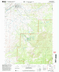
2001 Map of Paonia
USGS Topo · Published 2004About this map
Paonia serves as the gateway to the high country of the Gunnison National Forest at the start of the 21st century. The town is situated where the Gunnison River and Minnesota Creek meet, supporting a landscape of agricultural mesas and narrow mountain canyons. Stewart Mesa and Lamborn Mesa rise above the valley floor, each characterized by its own namesake school, Stewart Mesa Sch and Lamborn Sch, highlighting the distributed rural settlement pattern of Delta County. To the southeast, the terrain climbs sharply toward the high peaks of the West Elk Mountains, including the prominent Mount Lamborn and Landsend Peak. Traces of earlier mid-century community life are visible in features like the Drive-in Theater and the Bethlehem Cem, while the complex network of irrigation sources like Lone Cabin Reservoir and Inter Ocean Reservoir illustrates the engineering required to sustain orchards and farms in this high-altitude environment.
Find a feature on this map
45 named features on this map. Tap any name to fly to it.
Don’t see what you’re looking for? This feature index may not catch every label — zoom into the map to look around manually.
Map Details
Editions of this 2001 Paonia Map
This is the sole edition of this map. No revisions or reprints were ever made.
Other maps of this area

1938 · Mt. Gunnison
USGS Topo · 1:48,000

1945 · Mount Gunnison
USGS Topo · 1:62,500

1956 · Montrose
USGS Topo · 1:250,000

1959 · Montrose
USGS Topo · 1:250,000

1960 · Montrose
USGS Topo · 1:250,000

1964 · Minnesota Pass
USGS Topo · 1:24,000
1964 · Somerset
USGS Topo · 1:24,000
1965 · Gray Reservoir
USGS Topo · 1:24,000

1965 · Mount Guero
USGS Topo · 1:24,000
1965 · Paonia
USGS Topo · 1:24,000