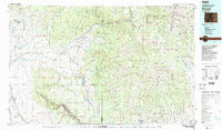
1983 Map of Paonia
USGS Topo · Published 1983About this map
Gunnison River and its North Fork define the industrial and agricultural heart of this West Slope landscape in the early 1980s. The map illustrates a region transitioning from the fertile orchards of Rogers Mesa and Fruitland Mesa to the high-country coal extraction near Somerset and Bowie. Extensive mining operations such as the Farmers Mine, Newman Mine, and Red Canyon Mine are situated among the steep drainages of the West Elk Mountains. Transportation routes like the Denver and Rio Grande Western railroad parallel the river corridors, serving the coal camps and agricultural centers of Hotchkiss and Paonia. In the southwest, the dramatic depth of the Black Canyon of the Gunnison is documented within the designated National Monument, contrasting with the engineered waters of the Paonia Reservoir to the north.
Find a feature on this map
83 named features on this map. Tap any name to fly to it.
Don’t see what you’re looking for? This feature index may not catch every label — zoom into the map to look around manually.
Map Details
Editions of this 1983 Paonia Map
2 editions found
Other maps of this area

1888 · Crested Butte
USGS Topo · 1:62,500

1888 · Anthracite
USGS Topo · 1:62,500

1889 · Crested Butte
USGS Topo · 1:62,500

1889 · Anthracite
USGS Topo · 1:62,500

1893 · Anthracite
USGS Topo · 1:62,500

1893 · Crested Butte
USGS Topo · 1:62,500

1893 · Aspen
USGS Topo · 1:62,500

1894 · Anthracite
USGS Topo · 1:62,500

1895 · Aspen
USGS Topo · 1:62,500

1908 · Uncompahgre
USGS Topo · 1:125,000