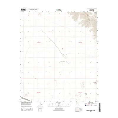
2014 Map of Paradise Canyon
USGS Topo · Published 2014About this map
Sierra Pinta dominates the northeastern corner of this borderland survey, casting its shadows over the arid expanse of the Tule Desert. This desert landscape is defined by its geological variety, where the drainage of Tule Wash cuts across the central plains toward the volcanic remnants of the Pinacate Lava Flow in the south. The terrain transitions from the high ridges of Eagle Canyon and Paradise Canyon to the flat, alkaline surface of Pinta Playa near the international boundary. Positioned along the divide between the United States and Mexico, the map documents a region where the vast Pinacate Valley meets the structured land divisions of the Public Land Survey System, illustrating the intersection of natural desert features and political demarcation.
Find a feature on this map
15 named features on this map. Tap any name to fly to it.
Don’t see what you’re looking for? This feature index may not catch every label — zoom into the map to look around manually.
Map Details
Editions of this 2014 Paradise Canyon Map
This is the sole edition of this map. No revisions or reprints were ever made.
Other maps of this area

1953 · Ajo
USGS Topo · 1:250,000

1957 · Ajo
USGS Topo · 1:250,000

1958 · Ajo
USGS Topo · 1:250,000

1962 · Ajo
USGS Topo · 1:250,000

1963 · Ajo
USGS Topo · 1:250,000

1965 · O'Neill Hills
USGS Topo · 1:62,500

1965 · Granite Mountains
USGS Topo · 1:62,500

1965 · Isla Pinta
USGS Topo · 1:62,500

1965 · Sierra Arida
USGS Topo · 1:62,500

1967 · Ajo
USGS Topo · 1:250,000