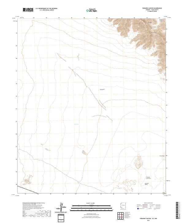
2021 Map of Paradise Canyon
USGS Topo · Published 2021About this map
Sierra Pinta defines the northern reaches of this arid landscape, where steep topography transitions into the expansive Tule Desert. This desert expanse is marked by the braided channels of Tule Wash, which drains the central basin towards the southeast. The map reveals a dramatic geomorphological shift in the southern sections, dominated by the Pinacate Lava Flow and the adjacent Pinacate Valley. These volcanic features represent a significant geological departure from the alluvial and mountain-front patterns found further north. Along the eastern edge, the terrain is carved by the deep incisions of Paradise Canyon and Eagle Canyon, while the presence of Pinta Playa suggests a low-lying area of seasonal water accumulation. The lack of built infrastructure highlights the environmental extremity of this portion of Yuma County.
Find a feature on this map
14 named features on this map. Tap any name to fly to it.
Don’t see what you’re looking for? This feature index may not catch every label — zoom into the map to look around manually.
Map Details
Editions of this 2021 Paradise Canyon Map
This is the sole edition of this map. No revisions or reprints were ever made.
Other maps of this area

1953 · Ajo
USGS Topo · 1:250,000

1957 · Ajo
USGS Topo · 1:250,000

1958 · Ajo
USGS Topo · 1:250,000

1962 · Ajo
USGS Topo · 1:250,000

1963 · Ajo
USGS Topo · 1:250,000

1965 · O'Neill Hills
USGS Topo · 1:62,500

1965 · Granite Mountains
USGS Topo · 1:62,500

1965 · Isla Pinta
USGS Topo · 1:62,500

1965 · Sierra Arida
USGS Topo · 1:62,500

1967 · Ajo
USGS Topo · 1:250,000