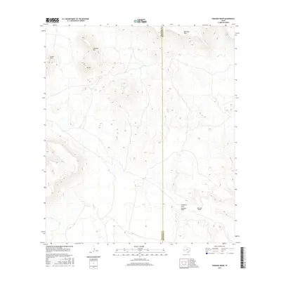
2016 Map of Paradise Draw
USGS Topo · Published 2016About this map
Paradise Valley and the surrounding high desert terrain define this corner of the Trans-Pecos, captured during a 2016 survey by the U.S. Geological Survey. The landscape is dominated by significant topographical landmarks such as Housetop Mtn, Hat Mtn, and the broad plateaus of Gemelo Mesa and Whirlwind Mesa. These features are bisected by an intricate network of seasonal drainage systems, most notably Paradise Draw and Hackberry Draw.
Find a feature on this map
10 named features on this map. Tap any name to fly to it.
Don’t see what you’re looking for? This feature index may not catch every label — zoom into the map to look around manually.
Map Details
Editions of this 2016 Paradise Draw Map
This is the sole edition of this map. No revisions or reprints were ever made.
Other maps of this area

1895 · Alpine
USGS Topo · 1:125,000

1917 · Buck Hill
USGS Topo · 1:62,500

1918 · Buck Hill
USGS Topo · 1:62,500

1918 · Jordan Gap
USGS Topo · 1:62,500

1925 · Buck Hill
USGS Topo · 1:62,500

1930 · Jordan Gap
USGS Topo · 1:62,500

1954 · Fort Stockton
USGS Topo · 1:250,000

1958 · Fort Stockton
USGS Topo · 1:250,000

1959 · Emory Peak
USGS Topo · 1:250,000

1965 · Emory Peak
USGS Topo · 1:250,000