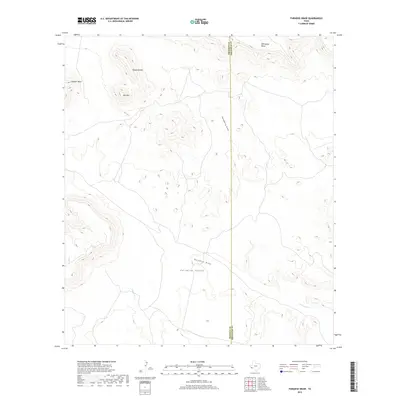
2019 Map of Paradise Draw
USGS Topo · Published 2019About this map
Paradise Valley lies at the heart of this high-desert landscape in the Big Bend region, where the arid terrain is defined by dramatic mesas and seasonal watercourses. The boundary between Presidio County and Brewster County bisects the sheet, following a north-south line through the center of the survey. This border area is marked by significant topographic rises including Whirlwind Mesa in the northeast and isolated peaks like Housetop Mtn and Hat Mtn to the west. The drainage network here is essential to understanding the local geography, with the intermittent Terlingua Cr cutting through the southeast corner and Paradise Draw and Hackberry Draw converging as they navigate the basin floor. The map captures a section of West Texas where land ownership and natural hydrology dictate the footprint of human activity across the expansive mesas.
Find a feature on this map
10 named features on this map. Tap any name to fly to it.
Don’t see what you’re looking for? This feature index may not catch every label — zoom into the map to look around manually.
Map Details
Editions of this 2019 Paradise Draw Map
This is the sole edition of this map. No revisions or reprints were ever made.
Other maps of this area

1895 · Alpine
USGS Topo · 1:125,000

1917 · Buck Hill
USGS Topo · 1:62,500

1918 · Buck Hill
USGS Topo · 1:62,500

1918 · Jordan Gap
USGS Topo · 1:62,500

1925 · Buck Hill
USGS Topo · 1:62,500

1930 · Jordan Gap
USGS Topo · 1:62,500

1954 · Fort Stockton
USGS Topo · 1:250,000

1958 · Fort Stockton
USGS Topo · 1:250,000

1959 · Emory Peak
USGS Topo · 1:250,000

1965 · Emory Peak
USGS Topo · 1:250,000